


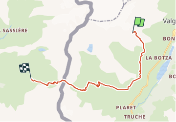
Refuge des anges vers refuge de l'archeboc

Stéphane Ruchet
User

Length
12.4 km

Max alt
2881 m

Uphill gradient
693 m
Km-Effort
24 km

Min alt
2028 m

Downhill gradient
1533 m
Boucle
No
Creation date :
2023-08-02 10:01:13.252
Updated on :
2023-08-02 11:26:31.748
5h32
Difficulty : Very difficult

FREE GPS app for hiking
 SityTrail
IGN / Geographical institutes
SityTrail Plus
The world is yours!
About
Trail Walking of 12.4 km to be discovered at Aosta Valley, Unknown, Valgrisenche. This trail is proposed by Stéphane Ruchet.
Positioning
Country:
Italy
Region :
Aosta Valley
Department/Province :
Unknown
Municipality :
Valgrisenche
Location:
Unknown
Start:(Dec)
Start:(UTM)
346429 ; 5054271 (32T) N.
Comments