


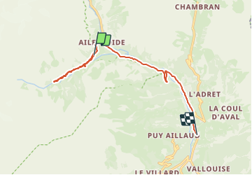
Ailefroide Le Sele

Vinceneux
User

Length
12 km

Max alt
1720 m

Uphill gradient
204 m
Km-Effort
15.8 km

Min alt
1233 m

Downhill gradient
517 m
Boucle
No
Creation date :
2023-08-06 13:31:17.631
Updated on :
2023-08-06 16:06:14.163
2h33
Difficulty : Difficult

FREE GPS app for hiking
 SityTrail
IGN / Geographical institutes
SityTrail Plus
The world is yours!
About
Trail Walking of 12 km to be discovered at Provence-Alpes-Côte d'Azur, Hautes-Alpes, Vallouise-Pelvoux. This trail is proposed by Vinceneux.
Positioning
Country:
France
Region :
Provence-Alpes-Côte d'Azur
Department/Province :
Hautes-Alpes
Municipality :
Vallouise-Pelvoux
Location:
Pelvoux
Start:(Dec)
Start:(UTM)
297979 ; 4973132 (32T) N.
Comments