


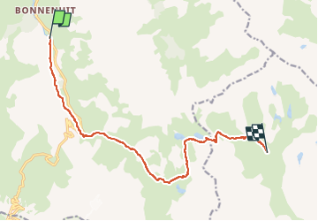
73 Valloire - Refuge des Drayères par lac des Cerces

trietsch
User

Length
12.5 km

Max alt
2583 m

Uphill gradient
848 m
Km-Effort
22 km

Min alt
1751 m

Downhill gradient
424 m
Boucle
No
Creation date :
2023-08-09 08:52:15.315
Updated on :
2024-05-20 12:04:39.828
5h05
Difficulty : Very difficult

FREE GPS app for hiking
 SityTrail
IGN / Geographical institutes
SityTrail Plus
The world is yours!
About
Trail Walking of 12.5 km to be discovered at Auvergne-Rhône-Alpes, Savoy, Valloire. This trail is proposed by trietsch.
Positioning
Country:
France
Region :
Auvergne-Rhône-Alpes
Department/Province :
Savoy
Municipality :
Valloire
Location:
Unknown
Start:(Dec)
Start:(UTM)
297348 ; 4998735 (32T) N.
Comments