


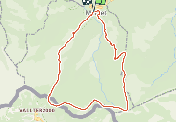
MANTET PORTEILLE ROC COLOM

FAUCET
User

Length
22 km

Max alt
2430 m

Uphill gradient
1124 m
Km-Effort
37 km

Min alt
1477 m

Downhill gradient
1126 m
Boucle
Yes
Creation date :
2023-08-09 05:12:22.824
Updated on :
2023-08-09 14:00:53.098
6h42
Difficulty : Very difficult

FREE GPS app for hiking
 SityTrail
IGN / Geographical institutes
SityTrail Plus
The world is yours!
About
Trail Walking of 22 km to be discovered at Occitania, Pyrénées-Orientales, Mantet. This trail is proposed by FAUCET.
Photos

Positioning
Country:
France
Region :
Occitania
Department/Province :
Pyrénées-Orientales
Municipality :
Mantet
Location:
Unknown
Start:(Dec)
Start:(UTM)
442922 ; 4703128 (31T) N.
Comments