


J1 de Méribel au refuge du grand plan

bymarc26
User
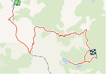

Length
12.8 km

Max alt
2687 m

Uphill gradient
674 m
Km-Effort
23 km

Min alt
2169 m

Downhill gradient
1060 m
Boucle
No
Creation date :
2023-08-09 07:49:42.922
Updated on :
2023-08-10 15:46:58.87
4h03
Difficulty : Difficult

FREE GPS app for hiking
 SityTrail
IGN / Geographical institutes
SityTrail Plus
The world is yours!
About
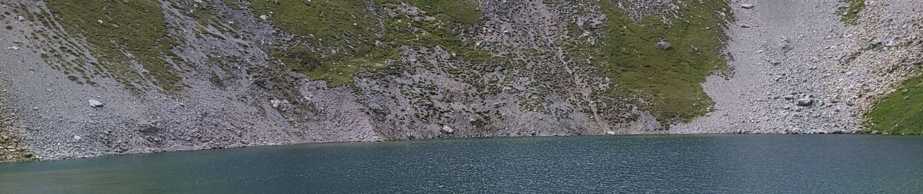
Trail Walking of 12.8 km to be discovered at Auvergne-Rhône-Alpes, Savoy, Courchevel. This trail is proposed by bymarc26.
Photos


Positioning
Country:
France
Region :
Auvergne-Rhône-Alpes
Department/Province :
Savoy
Municipality :
Courchevel
Location:
Saint-Bon-Tarentaise
Start:(Dec)
Start:(UTM)
312884 ; 5028069 (32T) N.
Comments