Trail Walking Menétrux-en-Joux - Ménétrux-en-Joux - cascades Evantail et Hérisson - Saut de la Forge - La Fromagerie - Photo

Ménétrux-en-Joux - cascades Evantail et Hérisson - Saut de la Forge - La Fromagerie

 Bart2015
Bart2015

User

© OpenStreetMap contributors
Length
Length
13.6 km
Max alt
Max alt
775 m
Uphill gradient
Uphill gradient
456 m
Km-Effort
Km-Effort  
19.7 km
Min alt
Min alt
525 m
Downhill gradient
Downhill gradient
462 m
Boucle
Boucle
Yes
Creation date :
2023-08-11 07:11:52.316
Updated on :
2023-08-11 16:14:18.804

(0 Reviews)

Walking
Walking
4h28
Difficulty : Very difficult

Scan this QR Code to open this trail in the SityTrail application

FREE GPS app for hiking

Logo SityTrail SityTrail

IGN / Geographical institutes

Download SityTrail from the App Store Download SityTrail from Google Play

Logo SityTrail SityTrail World

The world is yours!

Download SityTrail from the App Store Download SityTrail from Google Play Download SityTrail on Huawei AppGallery

About

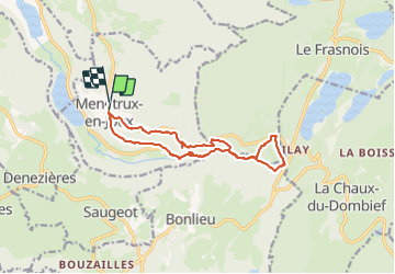
Trail Walking of 13.6 km to be discovered at Bourgogne-Franche-Comté, Jura, Menétrux-en-Joux. This trail is proposed by Bart2015.

Description

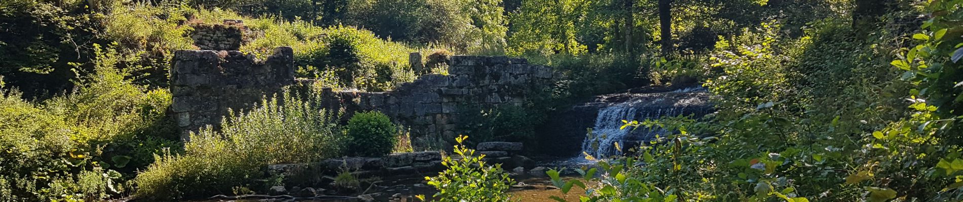
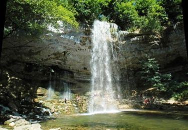
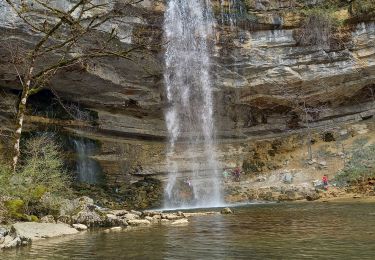
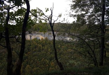
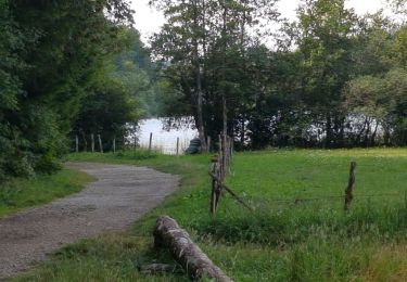
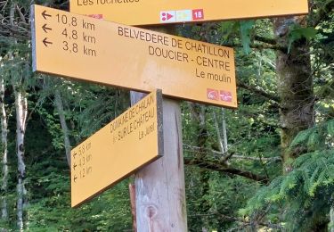
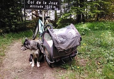
Belle randonnée au départ de Ménétrux pour éviter de payer le parking. Descente à la Maison des Cascades et le Saut de l'Evantail (haute de 65 m).  Départ ensuite pour une succession de cascades du Hérisson dont une haute de 60 m (Le Grand Saut). Attention le sol peut être glissant, donc s'équiper de bonnes chaussures ... Le sentier vous mène au magnifique Saut de la Forge avec la possibilité d'aller en dessous. Soyez prudent ... Retour en arrière ou si vous êtes motivé poursuivre jusqu'à La Fromagerie qui vous ramènera directement au Moulin Jeunet. Le retour passe par le Belvédère de l'Evantail qui surplombe la cascade. Vue magnifique sur la cascade et les alentours ... Arrivé à Ménétrux, pourquoi ne pas passer par le bar/resto éphémère de 2 mamies très sympatiques ...
Bonne rando ...

Elevation profile

Photos

28 photos in total. Please click on a photo to see them all in the gallery.

Positioning

Country:
France
Region :
Bourgogne-Franche-Comté
Department/Province :
Jura
Municipality :
Menétrux-en-Joux
Location:
Unknown
Start:(UTM)
716588 ; 5167242 (31T) N.

Trails nearby

Trail Walking Menétrux-en-Joux - Les cascades du Hérisson : Boucle du randonneur - Photo
Walking
VacheKiri67

Walking

Medium
(3)
Menétrux-en-Joux, Bourgogne-Franche-Comté, Jura, France
14.5 km | 20 km-effort
5h 10min
Yes
Trail Walking Menétrux-en-Joux - Le Hérisson et ses cascades - Photo
Walking
tracegps

Walking

Medium
(7)
Menétrux-en-Joux, Bourgogne-Franche-Comté, Jura, France
11.9 km | 17.6 km-effort
4h 0min
Yes
Trail Mountain bike Doucier -  La Dame Blanche - Doucier - Photo
Mountain bike
tracegps

Mountain bike

Difficult
(1)
Doucier, Bourgogne-Franche-Comté, Jura, France
33 km | 42 km-effort
2h 30min
Yes
Trail Walking Le Frasnois - lacs des maclut - Photo
Walking
bonj39

Walking

Very easy
(1)
Le Frasnois, Bourgogne-Franche-Comté, Jura, France
9.6 km | 12.1 km-effort
2h 1min
No
Trail Walking Le Frasnois - Ilay Menetrux en Joux cascades du Herisson - Photo
Walking
grasgilbert

Walking

Difficult
Le Frasnois, Bourgogne-Franche-Comté, Jura, France
12.7 km | 17.8 km-effort
4h 2min
Yes
Trail Walking Bonlieu - Cascades du Hérisson - Photo
Walking
GUIDE
David25400

Walking

Very easy
Bonlieu, Bourgogne-Franche-Comté, Jura, France
4.8 km | 7.6 km-effort
1h 56min
Yes
Trail Walking Le Frasnois - Rando des 4 lacs par le Pic de l'Aigle - Photo
Walking
Bart2015

Walking

Very difficult
Le Frasnois, Bourgogne-Franche-Comté, Jura, France
14.6 km | 19.9 km-effort
4h 30min
Yes
Trail Walking Doucier - Balisage Lac de Chambly - Photo
Walking
drarep

Walking

Difficult
(1)
Doucier, Bourgogne-Franche-Comté, Jura, France
11.4 km | 14.6 km-effort
3h 19min
Yes
Trail Mountain bike Bonlieu - Bonlieu Jura Col de joux 22.05.2023 - Photo
Mountain bike
lestetinesvertes

Mountain bike

Medium
Bonlieu, Bourgogne-Franche-Comté, Jura, France
41 km | 52 km-effort
3h 34min
Yes


Close
My subscriptions