Trail Walking Menétrux-en-Joux - Les cascades du Hérisson : Boucle du randonneur - Photo

Les cascades du Hérisson : Boucle du randonneur

© OpenStreetMap contributors
Length
Length
14.5 km
Max alt
Max alt
795 m
Uphill gradient
Uphill gradient
448 m
Km-Effort
Km-Effort  
20 km
Min alt
Min alt
525 m
Downhill gradient
Downhill gradient
448 m
Boucle
Boucle
Yes
Creation date :
2017-07-20 00:00:00.0
Updated on :
2017-07-20 00:00:00.0

(3 Reviews)

Walking
Walking
5h10
Difficulty : Medium

Scan this QR Code to open this trail in the SityTrail application

FREE GPS app for hiking

Logo SityTrail SityTrail

IGN / Geographical institutes

Download SityTrail from the App Store Download SityTrail from Google Play

Logo SityTrail SityTrail World

The world is yours!

Download SityTrail from the App Store Download SityTrail from Google Play Download SityTrail on Huawei AppGallery

About

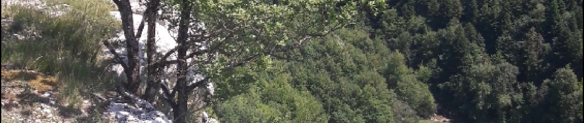
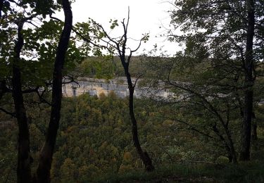
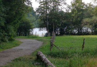
Trail Walking of 14.5 km to be discovered at Bourgogne-Franche-Comté, Jura, Menétrux-en-Joux. This trail is proposed by VacheKiri67.

Description

Faite le 18/07/2017 avec notre fils Théo de 12 ans.
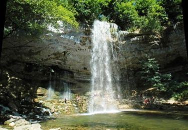
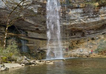
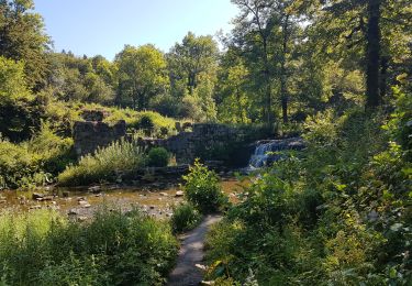
D'après http://www.jura-tourism.com/offre/fiche/le-herisson-et-ses-cascades/ITI|PED30007
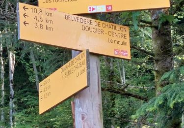
Durée indiquée pour le circuit : 4 heures. Balisage : Jaune (PR)

Elevation profile

Photos

38 photos in total. Please click on a photo to see them all in the gallery.

Positioning

Country:
France
Region :
Bourgogne-Franche-Comté
Department/Province :
Jura
Municipality :
Menétrux-en-Joux
Location:
Unknown
Start:(UTM)
716525 ; 5167547 (31T) N.

Comments

Please log in to post a review or rate the element


Ne pas hésiter à se munir de son maillot de bain et d'une serviette pour se rafraîchir sous les cascades.


Trails nearby

Trail Walking Menétrux-en-Joux - Le Hérisson et ses cascades - Photo
Walking
tracegps

Walking

Medium
(7)
Menétrux-en-Joux, Bourgogne-Franche-Comté, Jura, France
11.9 km | 17.6 km-effort
4h 0min
Yes
Trail Mountain bike Doucier -  La Dame Blanche - Doucier - Photo
Mountain bike
tracegps

Mountain bike

Difficult
(1)
Doucier, Bourgogne-Franche-Comté, Jura, France
33 km | 42 km-effort
2h 30min
Yes
Trail Walking Le Frasnois - lacs des maclut - Photo
Walking
bonj39

Walking

Very easy
(1)
Le Frasnois, Bourgogne-Franche-Comté, Jura, France
9.6 km | 12.1 km-effort
2h 1min
No
Trail Walking Le Frasnois - Ilay Menetrux en Joux cascades du Herisson - Photo
Walking
grasgilbert

Walking

Difficult
Le Frasnois, Bourgogne-Franche-Comté, Jura, France
12.7 km | 17.8 km-effort
4h 2min
Yes
Trail Walking Bonlieu - Cascades du Hérisson - Photo
Walking
GUIDE
David25400

Walking

Very easy
Bonlieu, Bourgogne-Franche-Comté, Jura, France
4.8 km | 7.6 km-effort
1h 56min
Yes
Trail Walking Le Frasnois - Rando des 4 lacs par le Pic de l'Aigle - Photo
Walking
Bart2015

Walking

Very difficult
Le Frasnois, Bourgogne-Franche-Comté, Jura, France
14.6 km | 19.9 km-effort
4h 30min
Yes
Trail Walking Menétrux-en-Joux - Ménétrux-en-Joux - cascades Evantail et Hérisson - Saut de la Forge - La Fromagerie - Photo
Walking
Bart2015

Walking

Very difficult
Menétrux-en-Joux, Bourgogne-Franche-Comté, Jura, France
13.6 km | 19.7 km-effort
4h 28min
Yes
Trail Walking Doucier - Balisage Lac de Chambly - Photo
Walking
drarep

Walking

Difficult
(1)
Doucier, Bourgogne-Franche-Comté, Jura, France
11.4 km | 14.6 km-effort
3h 19min
Yes
Trail Mountain bike Bonlieu - Bonlieu Jura Col de joux 22.05.2023 - Photo
Mountain bike
lestetinesvertes

Mountain bike

Medium
Bonlieu, Bourgogne-Franche-Comté, Jura, France
41 km | 52 km-effort
3h 34min
Yes


Close
My subscriptions