


Étape 3 - Refuge de l'Archeboc - Refuge Deffeyes

i20
User
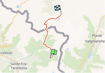

Length
15.7 km

Max alt
2675 m

Uphill gradient
1407 m
Km-Effort
33 km

Min alt
2007 m

Downhill gradient
937 m
Boucle
No
Creation date :
2023-08-13 05:17:42.708
Updated on :
2023-08-13 16:01:41.766
9h40
Difficulty : Difficult

FREE GPS app for hiking
 SityTrail
IGN / Geographical institutes
SityTrail Plus
The world is yours!
About
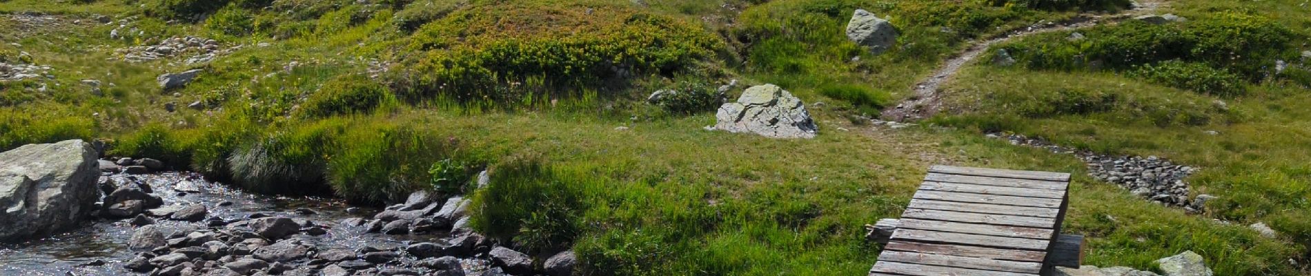
Trail Walking of 15.7 km to be discovered at Auvergne-Rhône-Alpes, Savoy, Sainte-Foy-Tarentaise. This trail is proposed by i20.
Photos


Positioning
Country:
France
Region :
Auvergne-Rhône-Alpes
Department/Province :
Savoy
Municipality :
Sainte-Foy-Tarentaise
Location:
Unknown
Start:(Dec)
Start:(UTM)
340823 ; 5051920 (32T) N.
Comments