


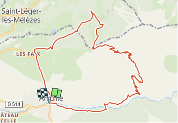
Ancelle - Le Cuchon

frizou83
User

Length
13.3 km

Max alt
1987 m

Uphill gradient
660 m
Km-Effort
22 km

Min alt
1340 m

Downhill gradient
662 m
Boucle
Yes
Creation date :
2023-08-13 16:54:44.223
Updated on :
2023-08-14 15:46:37.113
5h01
Difficulty : Very difficult

FREE GPS app for hiking
 SityTrail
IGN / Geographical institutes
SityTrail Plus
The world is yours!
About
Trail Walking of 13.3 km to be discovered at Provence-Alpes-Côte d'Azur, Hautes-Alpes, Ancelle. This trail is proposed by frizou83.
Positioning
Country:
France
Region :
Provence-Alpes-Côte d'Azur
Department/Province :
Hautes-Alpes
Municipality :
Ancelle
Location:
Unknown
Start:(Dec)
Start:(UTM)
278614 ; 4944762 (32T) N.
Comments