


chalet des nants

clsg
User
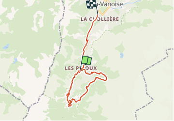

Length
14 km

Max alt
2213 m

Uphill gradient
549 m
Km-Effort
22 km

Min alt
1514 m

Downhill gradient
746 m
Boucle
No
Creation date :
2023-08-15 08:42:43.883
Updated on :
2023-08-15 13:38:52.007
4h55
Difficulty : Very difficult

FREE GPS app for hiking
 SityTrail
IGN / Geographical institutes
SityTrail Plus
The world is yours!
About
Trail Walking of 14 km to be discovered at Auvergne-Rhône-Alpes, Savoy, Pralognan-la-Vanoise. This trail is proposed by clsg.
Positioning
Country:
France
Region :
Auvergne-Rhône-Alpes
Department/Province :
Savoy
Municipality :
Pralognan-la-Vanoise
Location:
Unknown
Start:(Dec)
Start:(UTM)
319911 ; 5023958 (32T) N.
Comments