


montagnette

les randos d'Olivier
partout a pied et en moto

Length
394 m

Max alt
1345 m

Uphill gradient
36 m
Km-Effort
754 m

Min alt
1296 m

Downhill gradient
0 m
Boucle
No
Creation date :
2023-08-22 08:28:56.621
Updated on :
2023-08-22 08:37:09.406
10m
Difficulty : Easy

FREE GPS app for hiking
 SityTrail
IGN / Geographical institutes
SityTrail Plus
The world is yours!
About
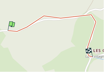
Trail Walking of 394 m to be discovered at Auvergne-Rhône-Alpes, Savoy, Flumet. This trail is proposed by les randos d'Olivier.
Positioning
Country:
France
Region :
Auvergne-Rhône-Alpes
Department/Province :
Savoy
Municipality :
Flumet
Location:
Unknown
Start:(Dec)
Start:(UTM)
310004 ; 5076770 (32T) N.
Comments