


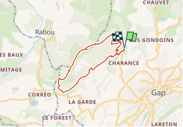
Montagne de Charance

frizou83
User

Length
14.1 km

Max alt
1889 m

Uphill gradient
919 m
Km-Effort
26 km

Min alt
1051 m

Downhill gradient
918 m
Boucle
Yes
Creation date :
2023-08-24 15:19:09.786
Updated on :
2025-05-24 06:11:19.482
5h58
Difficulty : Medium

FREE GPS app for hiking
 SityTrail
IGN / Geographical institutes
SityTrail Plus
The world is yours!
About
Trail On foot of 14.1 km to be discovered at Provence-Alpes-Côte d'Azur, Hautes-Alpes, Gap. This trail is proposed by frizou83.
Positioning
Country:
France
Region :
Provence-Alpes-Côte d'Azur
Department/Province :
Hautes-Alpes
Municipality :
Gap
Location:
Gap
Start:(Dec)
Start:(UTM)
266556 ; 4940793 (32T) N.
Comments