


refuge d'Avérole

geoffrayLayeux
User

Length
9.3 km

Max alt
2211 m

Uphill gradient
399 m
Km-Effort
14.6 km

Min alt
1834 m

Downhill gradient
398 m
Boucle
Yes
Creation date :
2023-08-28 21:12:32.993
Updated on :
2023-08-28 21:12:35.028
3h19
Difficulty : Difficult

FREE GPS app for hiking
 SityTrail
IGN / Geographical institutes
SityTrail Plus
The world is yours!
About
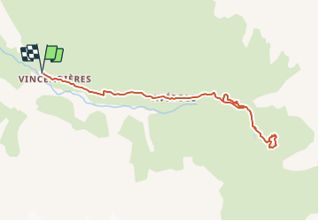
Trail Walking of 9.3 km to be discovered at Auvergne-Rhône-Alpes, Savoy, Bessans. This trail is proposed by geoffrayLayeux.
Positioning
Country:
France
Region :
Auvergne-Rhône-Alpes
Department/Province :
Savoy
Municipality :
Bessans
Location:
Unknown
Start:(Dec)
Start:(UTM)
346290 ; 5018925 (32T) N.
Comments