Trail Cycle Sainte-Marie-sur-Ouche - Pont de Pany . Panthier - Photo
© OpenStreetMap contributors
Length
Length
33 km
Max alt
Max alt
393 m
Uphill gradient
Uphill gradient
275 m
Km-Effort
Km-Effort  
36 km
Min alt
Min alt
275 m
Downhill gradient
Downhill gradient
169 m
Boucle
Boucle
No
Creation date :
2023-09-02 16:56:59.164
Updated on :
2023-09-02 16:59:16.905

(0 Reviews)

Cycle
Cycle
0m
Difficulty : Very easy
Bicycle tourism
Bicycle tourism
0m
Difficulty : Very easy

Scan this QR Code to open this trail in the SityTrail application

FREE GPS app for hiking

Logo SityTrail SityTrail

IGN / Geographical institutes

Download SityTrail from the App Store Download SityTrail from Google Play

Logo SityTrail SityTrail World

The world is yours!

Download SityTrail from the App Store Download SityTrail from Google Play Download SityTrail on Huawei AppGallery

About

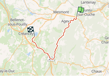
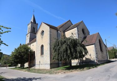
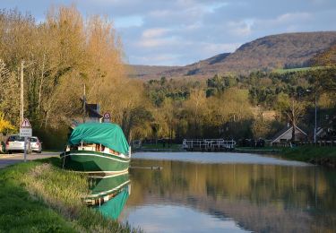
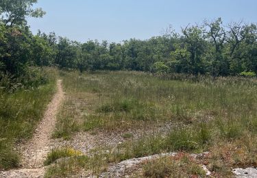
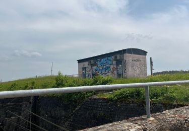
Trail Cycle of 33 km to be discovered at Bourgogne-Franche-Comté, Côte-d'Or, Sainte-Marie-sur-Ouche. This trail is proposed by jeanboulay.

Elevation profile

Positioning

Country:
France
Region :
Bourgogne-Franche-Comté
Department/Province :
Côte-d'Or
Municipality :
Sainte-Marie-sur-Ouche
Location:
Unknown
Start:(UTM)
637198 ; 5239914 (31T) N.

Trails nearby

Trail Walking Sainte-Marie-sur-Ouche - Pont de Pany - Photo
Walking
hueco

Walking

Easy
(1)
Sainte-Marie-sur-Ouche, Bourgogne-Franche-Comté, Côte-d'Or, France
11.4 km | 16 km-effort
3h 19min
Yes
Trail Walking Urcy - Les environs d'Urcy - Photo
Walking
tracegps

Walking

Difficult
(2)
Urcy, Bourgogne-Franche-Comté, Côte-d'Or, France
18.9 km | 27 km-effort
6h 0min
No
Trail Walking Sainte-Marie-sur-Ouche - Belvédères sur la vallée de l'Ouche - Pont de Pany - Photo
Walking
tracegps

Walking

Difficult
(1)
Sainte-Marie-sur-Ouche, Bourgogne-Franche-Comté, Côte-d'Or, France
20 km | 28 km-effort
6h 0min
Yes
Trail Walking Mâlain - Mâlain - Charmoy - Baulme le Roche - Photo
Walking
tracegps

Walking

Medium
(3)
Mâlain, Bourgogne-Franche-Comté, Côte-d'Or, France
15.3 km | 21 km-effort
3h 30min
Yes
Trail Walking Fleurey-sur-Ouche - Le Marathon de Fleurey sur Ouche - Photo
Walking
tracegps

Walking

Very difficult
(1)
Fleurey-sur-Ouche, Bourgogne-Franche-Comté, Côte-d'Or, France
40 km | 54 km-effort
10h 0min
Yes
Trail On foot Mâlain - Sentier du Mâlain - Photo
On foot
PRO

On foot

Easy
Mâlain, Bourgogne-Franche-Comté, Côte-d'Or, France
6.6 km | 10.5 km-effort
2h 22min
Yes
Trail On foot Fleurey-sur-Ouche - Sentier des Roches d'Orgères - Photo
On foot
PRO

On foot

Easy
Fleurey-sur-Ouche, Bourgogne-Franche-Comté, Côte-d'Or, France
4.2 km | 4.8 km-effort
1h 4min
Yes
Trail Walking Lantenay - Lantenay - Photo
Walking
eric.guyard21

Walking

Lantenay, Bourgogne-Franche-Comté, Côte-d'Or, France
4.4 km | 6.8 km-effort
1h 26min
No
Trail Walking Fleurey-sur-Ouche - Fleurey/lantenay - Photo
Walking
eric.guyard21

Walking

Difficult
Fleurey-sur-Ouche, Bourgogne-Franche-Comté, Côte-d'Or, France
14.4 km | 19.4 km-effort
3h 21min
Yes


Close
My subscriptions