


Mont Jovet

Chabard
User

Length
18.3 km

Max alt
2543 m

Uphill gradient
1047 m
Km-Effort
32 km

Min alt
1804 m

Downhill gradient
1040 m
Boucle
Yes
Creation date :
2023-09-05 06:53:45.0
Updated on :
2023-09-05 14:48:48.656
7h53
Difficulty : Difficult

FREE GPS app for hiking
 SityTrail
IGN / Geographical institutes
SityTrail Plus
The world is yours!
About
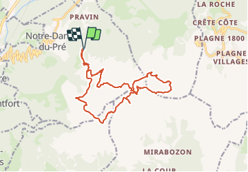
Trail Walking of 18.3 km to be discovered at Auvergne-Rhône-Alpes, Savoy, Notre-Dame-du-Pré. This trail is proposed by Chabard.
Description
Mont Jovet
Positioning
Country:
France
Region :
Auvergne-Rhône-Alpes
Department/Province :
Savoy
Municipality :
Notre-Dame-du-Pré
Location:
Unknown
Start:(Dec)
Start:(UTM)
313321 ; 5042206 (32T) N.
Comments