Trail Walking Clervaux - 2023-09-06_11h14m49_sentier-local-cl-2 - Photo

2023-09-06_11h14m49_sentier-local-cl-2

© OpenStreetMap contributors
Length
Length
7.1 km
Max alt
Max alt
465 m
Uphill gradient
Uphill gradient
210 m
Km-Effort
Km-Effort  
9.9 km
Min alt
Min alt
344 m
Downhill gradient
Downhill gradient
210 m
Boucle
Boucle
Yes
Creation date :
2023-09-06 09:14:49.023
Updated on :
2023-09-08 17:25:54.762

(1 Reviews)

Walking
Walking
2h14
Difficulty : Medium

Scan this QR Code to open this trail in the SityTrail application

FREE GPS app for hiking

Logo SityTrail SityTrail

IGN / Geographical institutes

Download SityTrail from the App Store Download SityTrail from Google Play

Logo SityTrail SityTrail World

The world is yours!

Download SityTrail from the App Store Download SityTrail from Google Play Download SityTrail on Huawei AppGallery

About

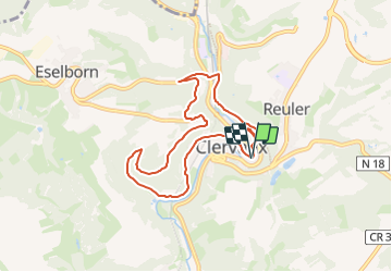
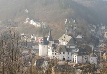
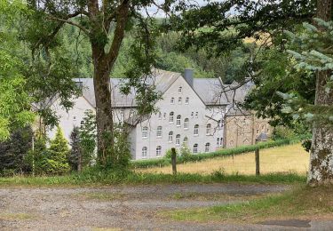
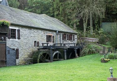
Trail Walking of 7.1 km to be discovered at Unknown, Canton Clervaux, Clervaux. This trail is proposed by mumu.larandonneuse.

Description

C'est une belle promenade qui vous fait découvrir tous les points forts de Clervaux.
Une bonne condition physique est requise mais la promenade n'est certainement pas très difficile.
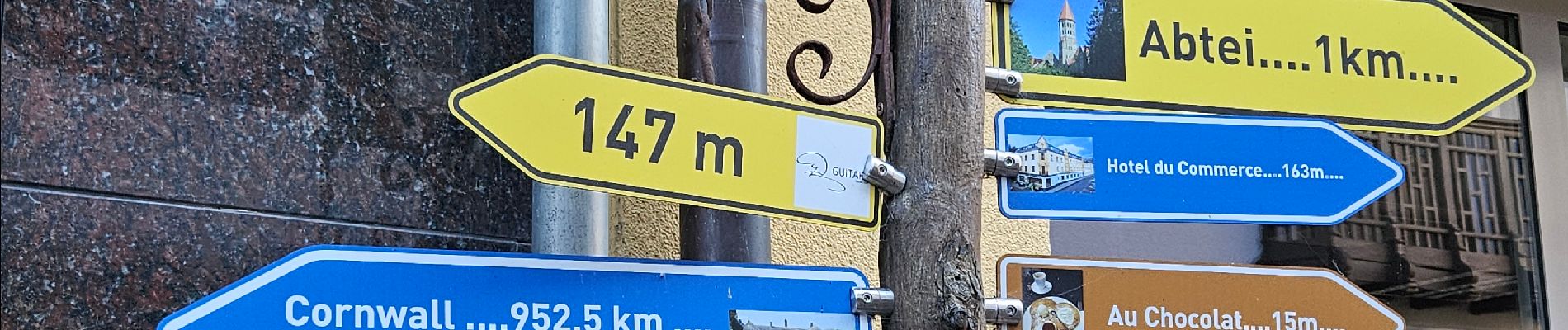
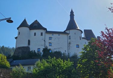
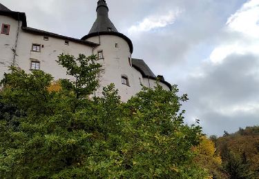
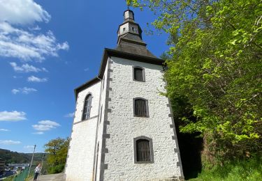
Bien sûr, au cours de cette promenade, vous visiterez le parc du château, l'église paroissiale avec ses belles tours jumelles qui est aussi une vue de l'intérieur, mais vous passerez aussi devant la chapelle de Loretto et, bien sûr, une visite à l'abbaye bénédictine de Saint-Maurice ne peut être manquée au cours de cette promenade.

Info pour le départ du camping :
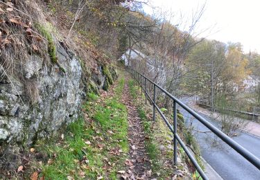
Il s'agit d'une boucle d'environ 7 km et vous récupérez l'itinéraire depuis le camping. Prenez à gauche en sortant du portail et suivez le sentier vers l'arrière, à l'arrêt de bus vous verrez la première indication "CL2" sur le lampadaire. De là, vous pouvez commencer à suivre cette indication.

Elevation profile

Photos

Positioning

Country:
Luxembourg
Region :
Unknown
Department/Province :
Canton Clervaux
Municipality :
Clervaux
Location:
Unknown
Start:(UTM)
287469 ; 5548816 (32U) N.

Comments

Please log in to post a review or rate the element


Superbe parcours très boisé et découverte de la rue piétonnière et commerçante de Clervaux.


Trails nearby

Trail Walking Clervaux - 2023-09-06_11h37m03_sentier-local-cl-5 - Photo
Walking
GUIDE
mumu.larandonneuse

Walking

Difficult
(1)
Clervaux, Unknown, Canton Clervaux, Luxembourg
12.5 km | 18.6 km-effort
4h 13min
Yes
Trail Walking Clervaux - Eislek Pad Clervaux - Photo
Walking
GUIDE+

Walking

Difficult
Clervaux, Unknown, Canton Clervaux, Luxembourg
13.2 km | 18.5 km-effort
4h 11min
Yes
Trail Walking Clervaux - Boucle Les paysages cachés - Tronçon 4 - Clervaux - Kautenbach - Photo
Walking
GUIDE+

Walking

Very easy
Clervaux, Unknown, Canton Clervaux, Luxembourg
26 km | 38 km-effort
Unknown
No
Trail Walking Clervaux - LW_CL_2 - Photo
Walking
jipysn

Walking

Medium
Clervaux, Unknown, Canton Clervaux, Luxembourg
6.6 km | 9.2 km-effort
2h 5min
Yes
Trail Walking Clervaux - Clervaux Abbaye et Mecher 10 km boucle - Photo
Walking
GUIDE
rvapeldo

Walking

Easy
Clervaux, Unknown, Canton Clervaux, Luxembourg
10 km | 13.8 km-effort
3h 29min
Yes
Trail Walking Wincrange - Escapardenne Eisleck Trail: Moulin d'Asselborn - Houffalize - Photo
Walking
dauzata

Walking

Medium
Wincrange, Unknown, Canton Clervaux, Luxembourg
20 km | 25 km-effort
5h 16min
No
Trail Walking Clervaux - Escapardenne Eisleck Trail: Clervaux - Moulin d'Asselborn - Photo
Walking
dauzata

Walking

Medium
Clervaux, Unknown, Canton Clervaux, Luxembourg
21 km | 30 km-effort
5h 43min
No
Trail On foot Wincrange - Auto Pedestre Boxhorn - Photo
On foot
PRO

On foot

Easy
Wincrange, Unknown, Canton Clervaux, Luxembourg
12 km | 15.8 km-effort
3h 34min
Yes
Trail On foot Wincrange - Wikiloc Urspelt Maulusmuhle - Photo
On foot
GUIDE
Peter.vdbergh

On foot

Medium
Wincrange, Unknown, Canton Clervaux, Luxembourg
13.5 km | 18.4 km-effort
4h 27min
Yes


Close
My subscriptions