


la Vanoise

cousam
User
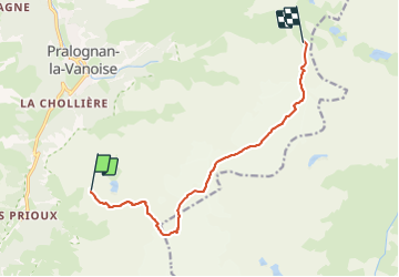

Length
10.5 km

Max alt
3343 m

Uphill gradient
923 m
Km-Effort
23 km

Min alt
2591 m

Downhill gradient
921 m
Boucle
No
Creation date :
2023-09-05 02:47:05.81
Updated on :
2023-09-13 14:49:00.208
13h01
Difficulty : Very difficult

FREE GPS app for hiking
 SityTrail
IGN / Geographical institutes
SityTrail Plus
The world is yours!
About
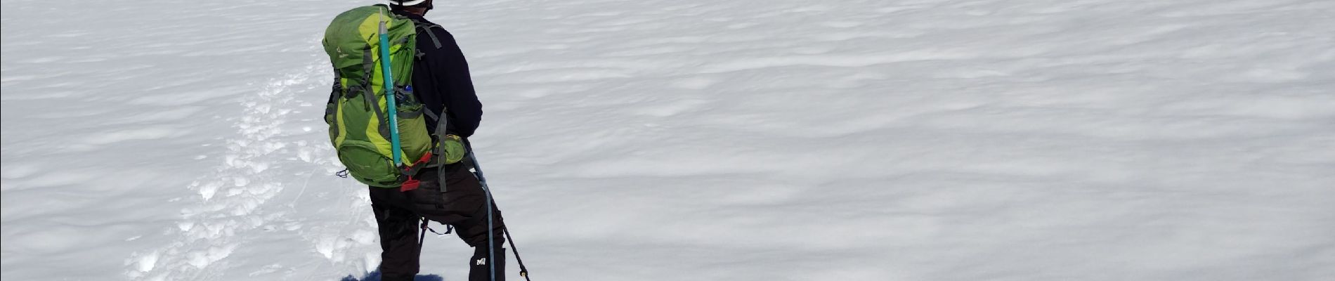
Trail Walking of 10.5 km to be discovered at Auvergne-Rhône-Alpes, Savoy, Pralognan-la-Vanoise. This trail is proposed by cousam.
Photos


Positioning
Country:
France
Region :
Auvergne-Rhône-Alpes
Department/Province :
Savoy
Municipality :
Pralognan-la-Vanoise
Location:
Unknown
Start:(Dec)
Start:(UTM)
321731 ; 5024725 (32T) N.
Comments