


Cadières de Brandis

taguette
User
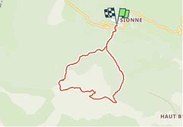

Length
8.1 km

Max alt
1558 m

Uphill gradient
425 m
Km-Effort
13.8 km

Min alt
1140 m

Downhill gradient
426 m
Boucle
Yes
Creation date :
2023-09-20 06:56:53.04
Updated on :
2023-09-20 09:31:31.291
2h26
Difficulty : Difficult

FREE GPS app for hiking
 SityTrail
IGN / Geographical institutes
SityTrail Plus
The world is yours!
About
Trail Walking of 8.1 km to be discovered at Provence-Alpes-Côte d'Azur, Alpes-de-Haute-Provence, Castellane. This trail is proposed by taguette.
Positioning
Country:
France
Region :
Provence-Alpes-Côte d'Azur
Department/Province :
Alpes-de-Haute-Provence
Municipality :
Castellane
Location:
Unknown
Start:(Dec)
Start:(UTM)
296237 ; 4860085 (32T) N.
Comments