Trail Walking Fréteval - Fréteval - Photo
 guydu41
guydu41

User

© OpenStreetMap contributors
Length
Length
10.8 km
Max alt
Max alt
152 m
Uphill gradient
Uphill gradient
125 m
Km-Effort
Km-Effort  
12.5 km
Min alt
Min alt
85 m
Downhill gradient
Downhill gradient
125 m
Boucle
Boucle
Yes
Creation date :
2023-09-27 07:02:44.041
Updated on :
2023-09-27 13:22:12.164

(0 Reviews)

Walking
Walking
2h50
Difficulty : Medium

Scan this QR Code to open this trail in the SityTrail application

FREE GPS app for hiking

Logo SityTrail SityTrail

IGN / Geographical institutes

Download SityTrail from the App Store Download SityTrail from Google Play

Logo SityTrail SityTrail World

The world is yours!

Download SityTrail from the App Store Download SityTrail from Google Play Download SityTrail on Huawei AppGallery

About

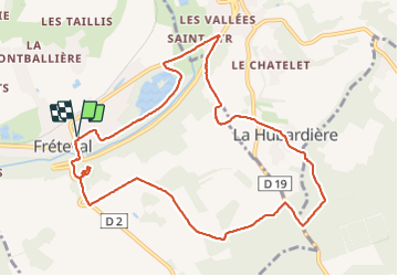
Trail Walking of 10.8 km to be discovered at Centre-Loire Valley, Loir-et-Cher, Fréteval. This trail is proposed by guydu41.

Description

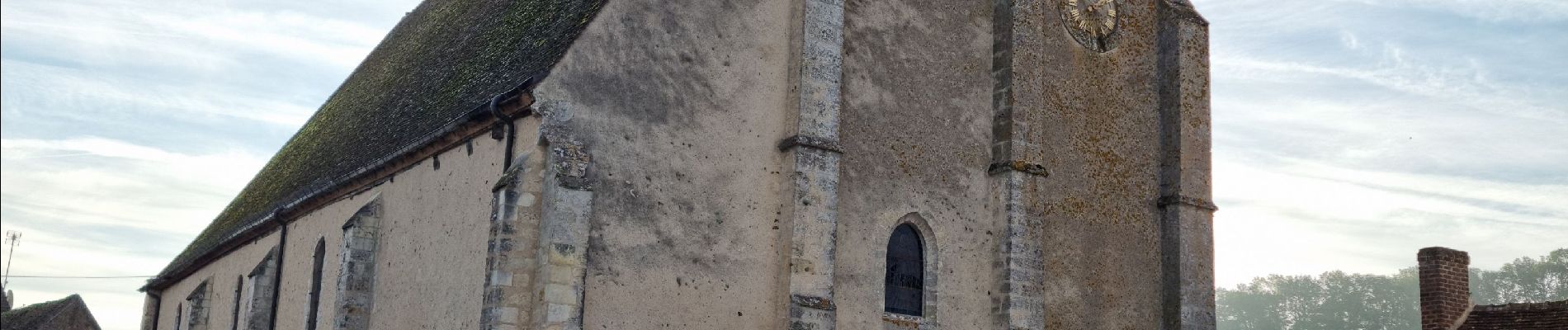
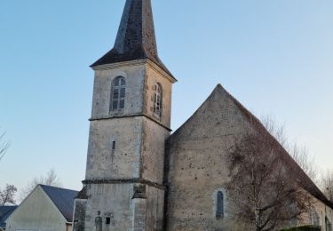
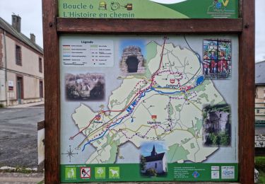
Ce circuit au départ d'un parking à côté de l'église Saint-Nicolas de Fréteval longe l'étang de Saint-Lubin, emprunte un chemin assez raide vers le haut du coteau, passe dans le joli hameau "La Hubardière", traverse la partie Ouest de la Forêt de Rocheux puis  des champs. En fin de parcours, il permet d'explorer et d'admirer le donjon et quelques remparts du château féodal de Fréteval au milieu d'un grand parc bien entretenu. Le retour emprunte un sentier pentu avec des marches descendant vers la vallée du Loir.

Elevation profile

Photos

38 photos in total. Please click on a photo to see them all in the gallery.

Positioning

Country:
France
Region :
Centre-Loire Valley
Department/Province :
Loir-et-Cher
Municipality :
Fréteval
Location:
Unknown
Start:(UTM)
366204 ; 5305496 (31T) N.

Trails nearby

Trail Walking Saint-Hilaire-la-Gravelle - Saint-Hilaire-la-Gravelle - Entre Loir et étangs  - Photo
Walking
guydu41

Walking

Easy
Saint-Hilaire-la-Gravelle, Centre-Loire Valley, Loir-et-Cher, France
16.5 km | 18.9 km-effort
4h 44min
Yes
Trail Walking Fréteval - Fréteval - L'histoire en chemin - Photo
Walking
guydu41

Walking

Easy
Fréteval, Centre-Loire Valley, Loir-et-Cher, France
19.7 km | 22 km-effort
6h 25min
Yes
Trail Cycle Fréteval - Circuit des 2 coteaux - Fréteval - Photo
Cycle
tracegps

Cycle

Difficult
Fréteval, Centre-Loire Valley, Loir-et-Cher, France
48 km | 54 km-effort
3h 0min
Yes
Trail Mountain bike Morée - Circuit de vallées et coteaux n° 3 - Morée - Photo
Mountain bike
tracegps

Mountain bike

Medium
Morée, Centre-Loire Valley, Loir-et-Cher, France
16.5 km | 18.9 km-effort
2h 0min
Yes
Trail Mountain bike Pezou - Rando Pezou 2009 - Photo
Mountain bike
tracegps

Mountain bike

Difficult
Pezou, Centre-Loire Valley, Loir-et-Cher, France
43 km | 50 km-effort
2h 45min
Yes
Trail Walking Fréteval - freteval 12 kms - Photo
Walking
migauthi

Walking

Very easy
Fréteval, Centre-Loire Valley, Loir-et-Cher, France
12.3 km | 14.1 km-effort
2h 44min
Yes
Trail Walking Fréteval - Freteval 27022022 - Photo
Walking
laurence41

Walking

Very difficult
Fréteval, Centre-Loire Valley, Loir-et-Cher, France
27 km | 30 km-effort
5h 20min
Yes
Trail On foot Fréteval - Randonnée Fréteval-Morée - Photo
On foot
Jean LABADIE

On foot

Medium
Fréteval, Centre-Loire Valley, Loir-et-Cher, France
19.5 km | 22 km-effort
5h 1min
Yes
Trail Walking Pezou - Le Chamort Pezou  - Photo
Walking
jackalv

Walking

Easy
Pezou, Centre-Loire Valley, Loir-et-Cher, France
12.8 km | 14.5 km-effort
3h 31min
Yes


Close
My subscriptions