


27 09 23 le Grand Arc

bymarc26
User
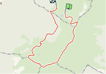

Length
9.4 km

Max alt
2456 m

Uphill gradient
750 m
Km-Effort
19.8 km

Min alt
1671 m

Downhill gradient
866 m
Boucle
No
Creation date :
2023-09-27 07:32:37.825
Updated on :
2023-09-28 10:21:52.124
4h05
Difficulty : Very difficult

FREE GPS app for hiking
 SityTrail
IGN / Geographical institutes
SityTrail Plus
The world is yours!
About
Trail Walking of 9.4 km to be discovered at Auvergne-Rhône-Alpes, Savoy, Sainte-Hélène-sur-Isère. This trail is proposed by bymarc26.
Description
bien suivre le balisage jaune pour monter au Grand Arc
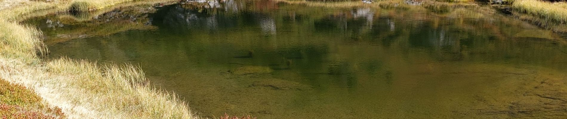
Photos


Positioning
Country:
France
Region :
Auvergne-Rhône-Alpes
Department/Province :
Savoy
Municipality :
Sainte-Hélène-sur-Isère
Location:
Unknown
Start:(Dec)
Start:(UTM)
294785 ; 5051482 (32T) N.
Comments