


ladignac

chanac les mines
User

Length
4.4 km

Max alt
454 m

Uphill gradient
194 m
Km-Effort
7 km

Min alt
330 m

Downhill gradient
194 m
Boucle
Yes
Creation date :
2023-09-29 07:49:49.285
Updated on :
2023-09-29 09:06:02.582
1h15
Difficulty : Medium

FREE GPS app for hiking
 SityTrail
IGN / Geographical institutes
SityTrail Plus
The world is yours!
About
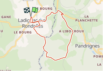
Trail Walking of 4.4 km to be discovered at New Aquitaine, Corrèze, Ladignac-sur-Rondelles. This trail is proposed by chanac les mines.
Positioning
Country:
France
Region :
New Aquitaine
Department/Province :
Corrèze
Municipality :
Ladignac-sur-Rondelles
Location:
Unknown
Start:(Dec)
Start:(UTM)
408773 ; 5009649 (31T) N.
Comments