


oderen

heurtinpatrick
User
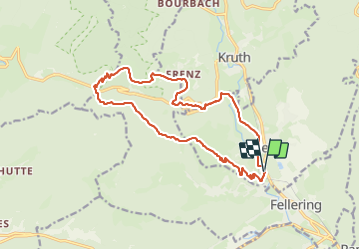

Length
16.3 km

Max alt
1077 m

Uphill gradient
700 m
Km-Effort
26 km

Min alt
444 m

Downhill gradient
700 m
Boucle
Yes
Creation date :
2023-10-01 07:38:43.947
Updated on :
2023-10-01 14:37:02.902
4h53
Difficulty : Difficult

FREE GPS app for hiking
 SityTrail
IGN / Geographical institutes
SityTrail Plus
The world is yours!
About
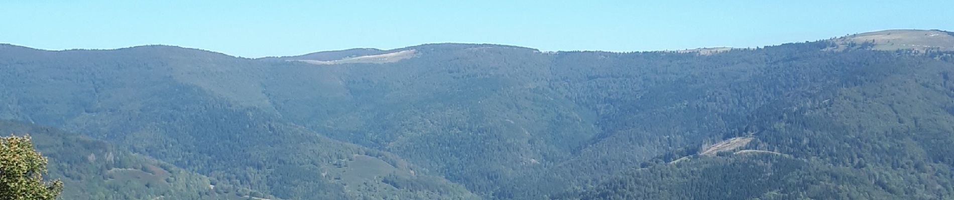
Trail Walking of 16.3 km to be discovered at Grand Est, Haut-Rhin, Oderen. This trail is proposed by heurtinpatrick.
Photos


Positioning
Country:
France
Region :
Grand Est
Department/Province :
Haut-Rhin
Municipality :
Oderen
Location:
Unknown
Start:(Dec)
Start:(UTM)
348673 ; 5307637 (32T) N.
Comments