Trail Walking Rivière-Pilote - Rivière Pilote : morne vent/rocher zombie  - Photo

Rivière Pilote : morne vent/rocher zombie

 chichine
chichine

User

© OpenStreetMap contributors
Length
Length
7.4 km
Max alt
Max alt
372 m
Uphill gradient
Uphill gradient
154 m
Km-Effort
Km-Effort  
10.7 km
Min alt
Min alt
9 m
Downhill gradient
Downhill gradient
515 m
Boucle
Boucle
No
Creation date :
2023-10-01 11:29:22.755
Updated on :
2023-10-01 15:46:27.171

(0 Reviews)

Walking
Walking
4h16
Difficulty : Medium

Scan this QR Code to open this trail in the SityTrail application

FREE GPS app for hiking

Logo SityTrail SityTrail

IGN / Geographical institutes

Download SityTrail from the App Store Download SityTrail from Google Play

Logo SityTrail SityTrail World

The world is yours!

Download SityTrail from the App Store Download SityTrail from Google Play Download SityTrail on Huawei AppGallery

About

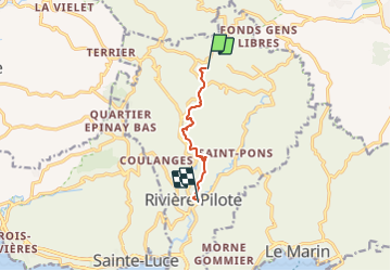
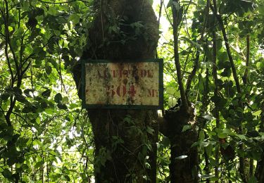
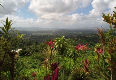
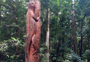
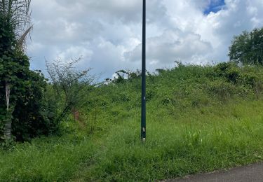
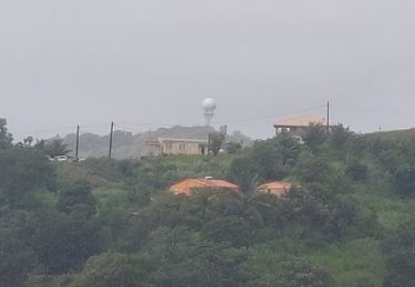
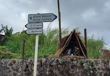
Trail Walking of 7.4 km to be discovered at Martinique, Unknown, Rivière-Pilote. This trail is proposed by chichine.

Description

Randonnée

Elevation profile

Photos

Positioning

Country:
France
Region :
Martinique
Department/Province :
Unknown
Municipality :
Rivière-Pilote
Location:
Unknown
Start:(UTM)
726463 ; 1607068 (20P) N.

Trails nearby

Trail Other activity Le Vauclin - Reco boucle montagne du Vauclin  - Photo
Other activity
GUIDE
manuelPerez

Other activity

Easy
(2)
Le Vauclin, Martinique, Unknown, France
10.3 km | 18.6 km-effort
4h 31min
Yes
Trail Walking Saint-Esprit - bois la Charles  - Photo
Walking
GUIDE
GabyG

Walking

Very easy
(1)
Saint-Esprit, Martinique, Unknown, France
2.2 km | 3.4 km-effort
1h 6min
No
Trail Walking Rivière-Pilote - Boucle La Mauny via Morne Vent - Photo
Walking
GUIDE
Lamartiniere

Walking

Difficult
Rivière-Pilote, Martinique, Unknown, France
10.7 km | 16.4 km-effort
4h 0min
Yes
Trail Walking Le Vauclin - Montagne Vauclin depuis gisquet  - Photo
Walking
GUIDE
manuelPerez

Walking

Le Vauclin, Martinique, Unknown, France
9.6 km | 17.3 km-effort
3h 56min
Yes
Trail Walking Le Vauclin - Montagne du Vauclin - Photo
Walking
GUIDE
David25400

Walking

Easy
Le Vauclin, Martinique, Unknown, France
4.9 km | 9.5 km-effort
2h 48min
Yes
Trail Walking Sainte-Luce - Forêt de Montravail - Photo
Walking
GUIDE
David25400

Walking

Very easy
Sainte-Luce, Martinique, Unknown, France
4.2 km | 6.3 km-effort
1h 36min
Yes
Trail Nordic walking Saint-Esprit - Forêt le Bois la CHARLES - Photo
Nordic walking
Ba Sa Balan

Nordic walking

Easy
Saint-Esprit, Martinique, Unknown, France
5.8 km | 7.8 km-effort
2h 1min
No
Trail Walking Le Vauclin - la montagne du Vauclin - Photo
Walking
chichine

Walking

Difficult
(1)
Le Vauclin, Martinique, Unknown, France
8.2 km | 14.8 km-effort
3h 42min
Yes
Trail Walking Le Vauclin - ,Boucle Montagne Vauclin via Coq. - Photo
Walking
GUIDE
Lamartiniere

Walking

Medium
Le Vauclin, Martinique, Unknown, France
5.1 km | 9.9 km-effort
3h 0min
Yes


Close
My subscriptions