


Flxlanden

ROPPJP
User
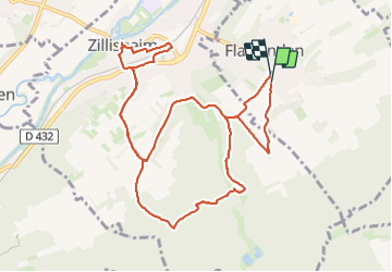

Length
11.9 km

Max alt
329 m

Uphill gradient
224 m
Km-Effort
14.9 km

Min alt
249 m

Downhill gradient
228 m
Boucle
Yes
Creation date :
2023-10-05 07:23:01.336
Updated on :
2023-10-05 13:01:51.451
4h32
Difficulty : Difficult

FREE GPS app for hiking
 SityTrail
IGN / Geographical institutes
SityTrail Plus
The world is yours!
About
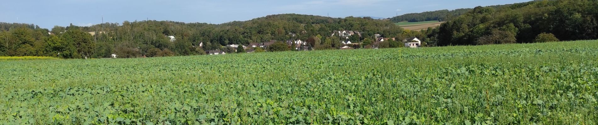
Trail Walking of 11.9 km to be discovered at Grand Est, Haut-Rhin, Flaxlanden. This trail is proposed by ROPPJP.
Photos


Positioning
Country:
France
Region :
Grand Est
Department/Province :
Haut-Rhin
Municipality :
Flaxlanden
Location:
Unknown
Start:(Dec)
Start:(UTM)
373743 ; 5283493 (32T) N.
Comments