


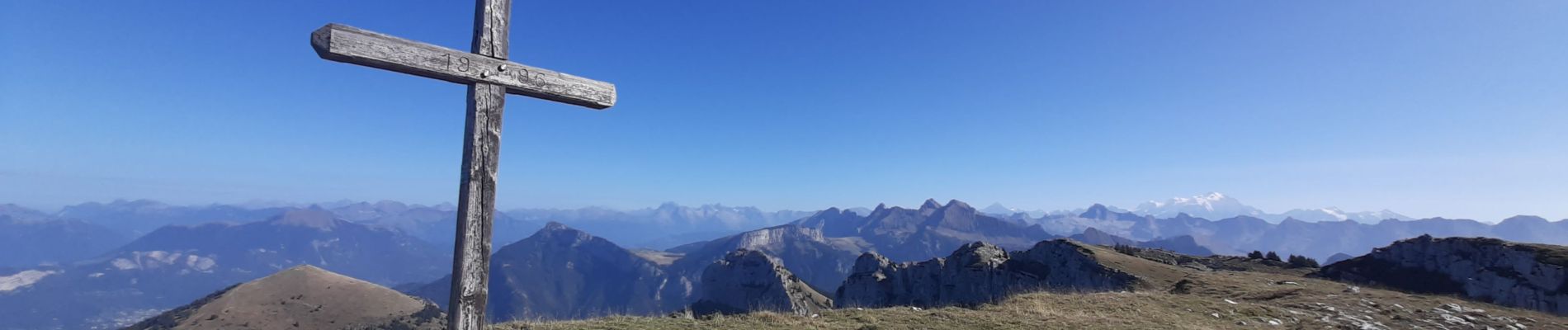
SOUS DINE PAR LE PAS DU ROC

djeepee74
User

Length
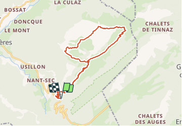
18.2 km

Max alt
1999 m

Uphill gradient
1188 m
Km-Effort
34 km

Min alt
923 m

Downhill gradient
1189 m
Boucle
Yes
Creation date :
2023-10-07 06:00:56.964
Updated on :
2023-10-16 17:37:07.901
7h44
Difficulty : Difficult

FREE GPS app for hiking
 SityTrail
IGN / Geographical institutes
SityTrail Plus
The world is yours!
About
Trail Walking of 18.2 km to be discovered at Auvergne-Rhône-Alpes, Upper Savoy, Fillière. This trail is proposed by djeepee74.
Description
BOUCLE... live du 20231007
Très jolie randonnée. De bonne heure vous êtes seul-e-s avec les vaches 🥰 . Karine.
Photos


Positioning
Country:
France
Region :
Auvergne-Rhône-Alpes
Department/Province :
Upper Savoy
Municipality :
Fillière
Location:
Thorens-Glières
Start:(Dec)
Start:(UTM)
290744 ; 5094221 (32T) N.
Comments