


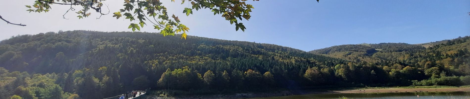
très, lac de la lauch

jcguew
User

Length
13.4 km

Max alt
1212 m

Uphill gradient
433 m
Km-Effort
19.2 km

Min alt
935 m

Downhill gradient
431 m
Boucle
Yes
Creation date :
2023-10-08 07:56:49.528
Updated on :
2023-10-15 15:08:16.753
5h01
Difficulty : Very difficult

FREE GPS app for hiking
 SityTrail
IGN / Geographical institutes
SityTrail Plus
The world is yours!
About
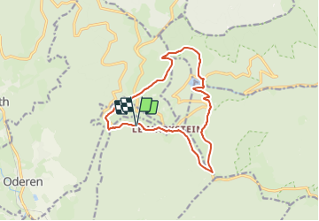
Trail Walking of 13.4 km to be discovered at Grand Est, Haut-Rhin, Ranspach. This trail is proposed by jcguew.
Description
Treh, steinlenbach,Oberlauchen, lac de la Lauch, Hofried, Hundsrucken, Markstein, Treh
Photos

Positioning
Country:
France
Region :
Grand Est
Department/Province :
Haut-Rhin
Municipality :
Ranspach
Location:
Unknown
Start:(Dec)
Start:(UTM)
352068 ; 5309771 (32T) N.
Comments