


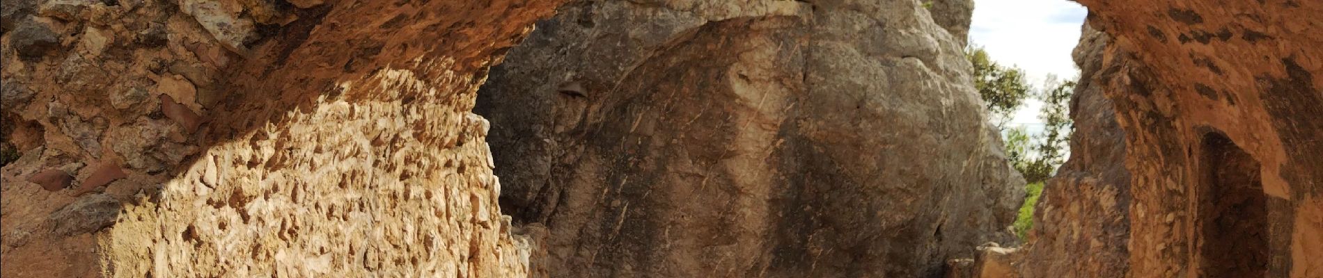
Pas du Clapier

cousam
User
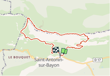

Length
11.4 km

Max alt
973 m

Uphill gradient
726 m
Km-Effort
21 km

Min alt
436 m

Downhill gradient
721 m
Boucle
Yes
Creation date :
2023-10-22 06:45:13.774
Updated on :
2023-10-23 13:38:19.965
8h41
Difficulty : Difficult

FREE GPS app for hiking
 SityTrail
IGN / Geographical institutes
SityTrail Plus
The world is yours!
About
Trail Walking of 11.4 km to be discovered at Provence-Alpes-Côte d'Azur, Bouches-du-Rhône, Saint-Antonin-sur-Bayon. This trail is proposed by cousam.
Photos


Positioning
Country:
France
Region :
Provence-Alpes-Côte d'Azur
Department/Province :
Bouches-du-Rhône
Municipality :
Saint-Antonin-sur-Bayon
Location:
Unknown
Start:(Dec)
Start:(UTM)
709225 ; 4821861 (31T) N.
Comments