


la Sagnette

Mascart
User

Length
2.8 km

Max alt
4 m

Uphill gradient
9 m
Km-Effort
2.9 km

Min alt
-3 m

Downhill gradient
8 m
Boucle
No
Creation date :
2023-10-27 09:35:06.535
Updated on :
2023-10-27 10:17:12.089
2h40
Difficulty : Easy

FREE GPS app for hiking
 SityTrail
IGN / Geographical institutes
SityTrail Plus
The world is yours!
About
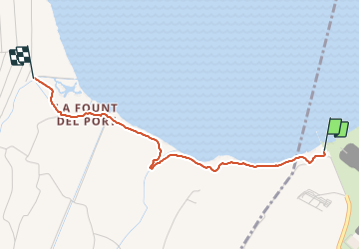
Trail Walking of 2.8 km to be discovered at Occitania, Pyrénées-Orientales, Saint-Laurent-de-la-Salanque. This trail is proposed by Mascart.
Description
via ste hyppolyte
Positioning
Country:
France
Region :
Occitania
Department/Province :
Pyrénées-Orientales
Municipality :
Saint-Laurent-de-la-Salanque
Location:
Unknown
Start:(Dec)
Start:(UTM)
499640 ; 4738667 (31T) N.
Comments