


12.5 km | 18.6 km-effort


« L’heure de la fin des découvertes ne sonne jamais. » Colette GUIDE+


FREE GPS app for hiking
 SityTrail
IGN / Geographical institutes
SityTrail World
The world is yours!
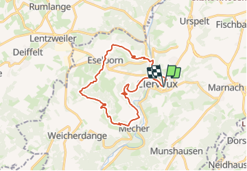
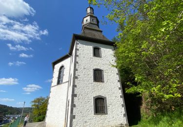
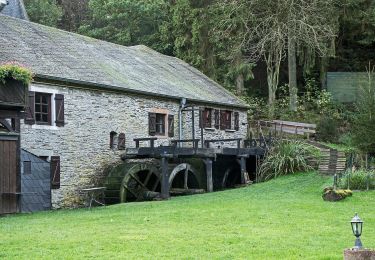
Trail Walking of 13.2 km to be discovered at Unknown, Canton Clervaux, Clervaux. This trail is proposed by Au fil de nos découvertes.
Et c'est... incroyablement beau ! 😱😍
- Et pas très loin de la frontière belge ! 😍
🅿️ Départ et Parking:
Tourist info
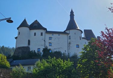
11 Grand rue
9710 Clervaux (Luxembourg)
⌚Boucle de /- 13,2km pour une durée de 4h15
🚶Niveau modéré
▶️ Suivre la balise "cercle jaune, demi cercle bleu, demi cercle vert"
🥾 Prévoir de bonnes chaussures de marche.
De nombreuses balades sont faisables de ce point de départ.
🌲🌳
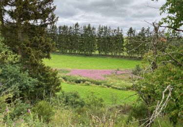
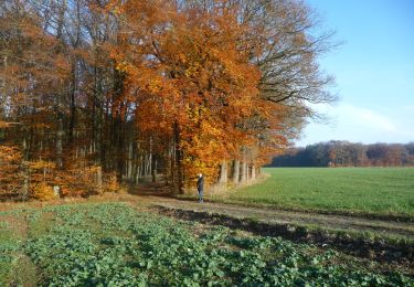
Nous avons eu la chance de faire cette randonnée sous le soleil (la plupart du temps), ce qui mettait encore en avant les couleurs automnales. 🍄🍁🍂
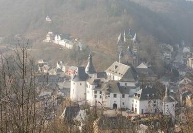
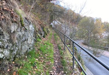
Cette promenade vous emmène majoritairement dans la forêt mais également dans les campagnes. 🍂🌳
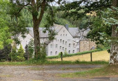
Vous aurez l'occasion de faire une halte à Eselborn, pour reprendre un peu d'énergie pour continuer vers Clervaux.
Possibilités de pique-niquer. 🥪🍴
Chiens autorisés en laisse. 🐩🐶🐕
Convient pour les enfants. 👱👱♂️
Ne convient pas pour les poussettes et personnes à mobilité réduite. 👨🦽👩🦽👶
N'hésitez pas à aller faire un tour sur notre site internet : www.aufildenosdecouvertes.com
Instagram :
https://instagram.com/au_fil_de_nos_decouvertes…


59 photos in total. Please click on a photo to see them all in the gallery.
Walking
Walking
Walking
Walking
Walking
Walking
Walking
On foot
On foot