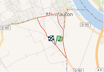

15.4 km | 18.6 km-effort


User


FREE GPS app for hiking
 SityTrail
IGN / Geographical institutes
SityTrail World
The world is yours!
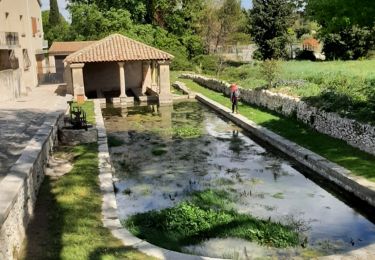
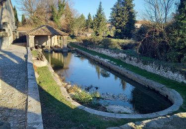
Trail Running of 2.9 km to be discovered at Occitania, Gard, Saint-Geniès-de-Comolas. This trail is proposed by adye.
C'est pas compliqué tu vois 😘

Walking

Walking
Walking
Walking
Walking