


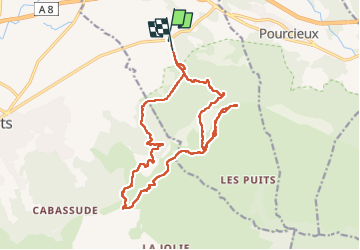


17.3 km | 27 km-effort


User


FREE GPS app for hiking
 SityTrail
IGN / Geographical institutes
SityTrail World
The world is yours!
Trail Walking of 20 km to be discovered at Provence-Alpes-Côte d'Azur, Var, Pourrières. This trail is proposed by ETMU5496.
- Départ 8h30 du parking (coord GPS = 43.4677;5.7450)
- 2,6 km de piste facile puis bifurcation tracé rouge sur sentier
Cela monte progressivement avec roche affleurante (partie boisée tracé rouge)
- A 3,3 km, prendre piste montante à gauche (balisage rouge)
- A 4,1 km , citerne enterrée et vieille partie goudronnée
- A 4,6 km monte tjs progressivement (211 D ) sous partie boisée et piste accidentée de 3 m de large.
Se monte bien sans difficulté (4,5 de moyenne)
- 6 km et 270 D . Tjs 4,5 moyenne. La piste est moins accidentée
- 7,2 km et 292 D : prendre piste à gauche près citerne enterrée. Partie goudronnée
- 7,7 km et 335 D : quitter par la gauche. Balisé jaune. Remarque un panneau propriété privée 🤔
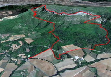
- 8,1 km et 350 D : début sentier et ascension mont Olympe. Bcp de cailloux
- Ascension difficile. Suivre balises jaunes de temps à autre.
- Mont Olympe : 9 km et 550 D . 2h15 depuis départ parking
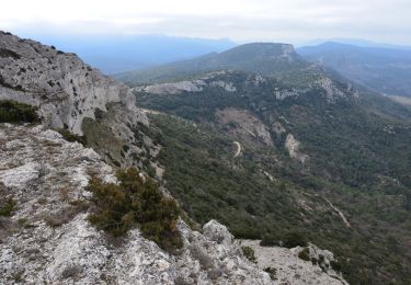
- La progression sur la crête balisée jaune ne pose pas de difficultés particulières et offre de beaux points de vue.
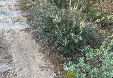
Végétation abondante aux abords du rocher de onze heures. Le sentier est ponctué par endroits de qqes points rouges
- 11 km et 6m25 D : sommet du rocher de onze heures. 2h50 de marche hors arrêts.
- 11,5 km et 630 D : traversée piste des contrebandiers
- Début ascension de l'Olympe vers crête du mont Aurélien
(tracé rouge)
- 12,3 km et 773 D : l’Olympe gravit 3h20 de marche hors arrêt
- 13,5 km et 820 D : l’arche est enfin trouvé. L’entrée est dans un bosquet vers le pas du Titet.
- Déjeuner à 14h : 14 km et 850 D
- Remontée à l’Olympe car A/R : 14,8 km et 920 D
- 15,5 km et 920 D : arrivée à nouveau au sentier dés contrebandiers pour le chemin du retour
- Km 16,4 : 1er PR possible à gauche pour retourner parking
- Km 17,6 : 2e PR possible pour retourner parking (tracé bleu). Celui-ci est privilégié car permet d’accéder aux vestiges archéologiques par une montée raide mais très courte. Cet A/R présente peu d’intérêt en réalité.
- Descente par sentier bleu raviné et caillouteux => vigilance. Il y a près de 300 D- jusqu’au parking
- Km 18,5 : on retrouve une piste large et on prend à gauche tjs sur le PR
- Km 19,4, on récupère le chemin aller du matin pour aller jusqu’au parking. Il reste un peu plus de deux km
- Arrivée à 16h20 et 5h40 de marche effective (hors arrêts)


72 photos in total. Please click on a photo to see them all in the gallery.
Walking

Walking
Walking
Walking
Walking
Walking
Walking
Walking
Walking