


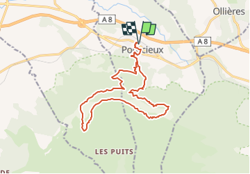

17.3 km | 27 km-effort


User


FREE GPS app for hiking
 SityTrail
IGN / Geographical institutes
SityTrail World
The world is yours!
Trail Walking of 18.2 km to be discovered at Provence-Alpes-Côte d'Azur, Var, Pourcieux. This trail is proposed by Levant .
Départ du village de Pourcieux
La coquille
Rejoindre le chemin des contrebandiers
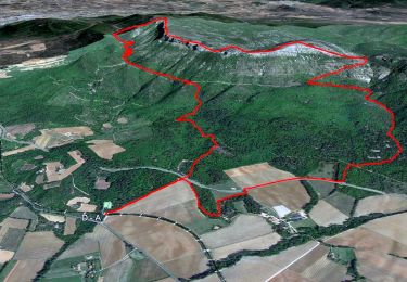
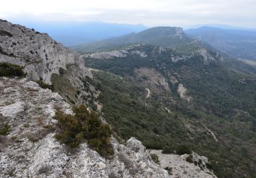
Gagner les crêtes par le collet Redon
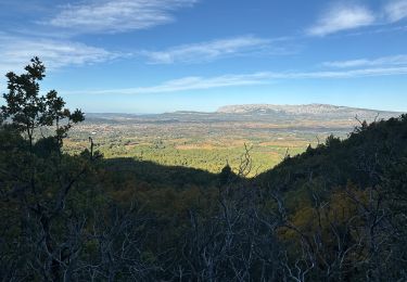
Suivre la crête du Mont Aurélien du Pas des Ifs jusqu'au bout de L'Olympe
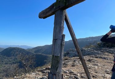
Visite des vestiges Archéologiques
Retour vers Pourcieux
Walking

Walking
Walking
Walking
Walking
Walking
Walking
Walking
Walking