


la dispute

NADINE52
User
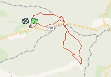

Length
10.1 km

Max alt
554 m

Uphill gradient
146 m
Km-Effort
12 km

Min alt
469 m

Downhill gradient
149 m
Boucle
Yes
Creation date :
2023-11-19 09:04:41.377
Updated on :
2023-11-19 13:23:17.688
2h42
Difficulty : Difficult

FREE GPS app for hiking
 SityTrail
IGN / Geographical institutes
SityTrail Plus
The world is yours!
About
Trail Walking of 10.1 km to be discovered at Provence-Alpes-Côte d'Azur, Bouches-du-Rhône, Vauvenargues. This trail is proposed by NADINE52.
Description
j.f..marie. m.claude..francoise
Positioning
Country:
France
Region :
Provence-Alpes-Côte d'Azur
Department/Province :
Bouches-du-Rhône
Municipality :
Vauvenargues
Location:
Unknown
Start:(Dec)
Start:(UTM)
717055 ; 4825878 (31T) N.
Comments