Trail Walking Pierrefitte-en-Cinglais - A/R depuis le Val héré - Photo

A/R depuis le Val héré

© OpenStreetMap contributors
Length
Length
4 km
Max alt
Max alt
136 m
Uphill gradient
Uphill gradient
45 m
Km-Effort
Km-Effort  
4.6 km
Min alt
Min alt
96 m
Downhill gradient
Downhill gradient
45 m
Boucle
Boucle
Yes
Creation date :
2023-11-23 18:07:07.27
Updated on :
2023-11-23 18:07:08.737

(0 Reviews)

Walking
Walking
1h02
Difficulty : Easy

Scan this QR Code to open this trail in the SityTrail application

FREE GPS app for hiking

Logo SityTrail SityTrail

IGN / Geographical institutes

Download SityTrail from the App Store Download SityTrail from Google Play

Logo SityTrail SityTrail World

The world is yours!

Download SityTrail from the App Store Download SityTrail from Google Play Download SityTrail on Huawei AppGallery

About

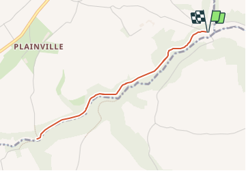
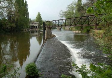
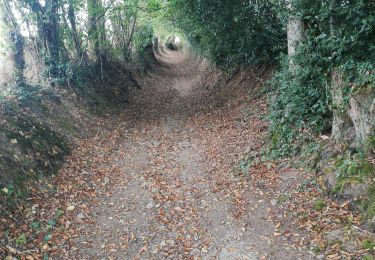
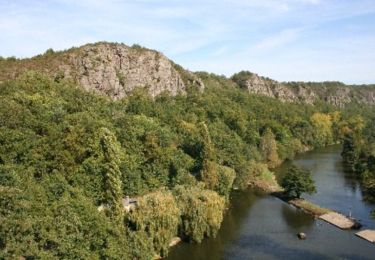
Trail Walking of 4 km to be discovered at Normandy, Calvados, Pierrefitte-en-Cinglais. This trail is proposed by latribuduchesnay.
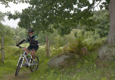
Elevation profile

Positioning

Country:
France
Region :
Normandy
Department/Province :
Calvados
Municipality :
Pierrefitte-en-Cinglais
Location:
Unknown
Start:(UTM)
692754 ; 5418914 (30U) N.

Trails nearby

Trail Mountain bike Pont-d'Ouilly - La Petite Suisse Normande 2014 - Pont-d'Ouilly - Photo
Mountain bike
tracegps

Mountain bike

Difficult
(1)
Pont-d'Ouilly, Normandy, Calvados, France
41 km | 54 km-effort
3h 30min
Yes
Trail On foot Pont-d'Ouilly - Circuit du Val la Hère - Photo
On foot
PRO

On foot

Easy
Pont-d'Ouilly, Normandy, Calvados, France
6.7 km | 9.4 km-effort
2h 7min
Yes
Trail On foot La Pommeraye - Les Rochers de Briesvieille - Photo
On foot
PRO

On foot

Easy
La Pommeraye, Normandy, Calvados, France
9.1 km | 12.9 km-effort
2h 55min
No
Trail On foot Ménil-Vin - Circuit des Saulces - Photo
On foot
PRO

On foot

Easy
Ménil-Vin, Normandy, Orne, France
12.4 km | 14.9 km-effort
3h 23min
Yes
Trail On foot Le Mesnil-Villement - Tour du Pays de Falaise - Photo
On foot
PRO

On foot

Easy
Le Mesnil-Villement, Normandy, Calvados, France
8.6 km | 11.9 km-effort
2h 42min
No
Trail Walking Pont-d'Ouilly - Entre l'Orne et la Rouvre - Photo
Walking
tracegps

Walking

Very difficult
Pont-d'Ouilly, Normandy, Calvados, France
21 km | 28 km-effort
5h 30min
Yes
Trail Walking Pont-d'Ouilly - Pont d'ouilly 220920 - Photo
Walking
Roulland

Walking

Medium
Pont-d'Ouilly, Normandy, Calvados, France
15.6 km | 21 km-effort
3h 56min
Yes
Trail Mountain bike Pont-d'Ouilly - La Goubinière - Le Bourg d'Ouilly - Photo
Mountain bike
tracegps

Mountain bike

Difficult
Pont-d'Ouilly, Normandy, Calvados, France
44 km | 59 km-effort
4h 30min
Yes
Trail Mountain bike Ménil-Hubert-sur-Orne - Rando raid du Pont d'Ouilly - 35 km - 2011 - Photo
Mountain bike
tracegps

Mountain bike

Difficult
Ménil-Hubert-sur-Orne, Normandy, Orne, France
34 km | 43 km-effort
2h 30min
No


Close
My subscriptions