


chamadelle

luluc
User

Length
16.4 km

Max alt
87 m

Uphill gradient
235 m
Km-Effort
19.5 km

Min alt
15 m

Downhill gradient
234 m
Boucle
Yes
Creation date :
2023-12-23 08:47:41.84
Updated on :
2023-12-23 14:31:55.588
5h43
Difficulty : Very difficult

FREE GPS app for hiking
 SityTrail
IGN / Geographical institutes
SityTrail Plus
The world is yours!
About
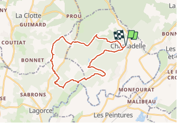
Trail Walking of 16.4 km to be discovered at New Aquitaine, Gironde, Chamadelle. This trail is proposed by luluc .
Description
petites routes et de jolis bois.
Positioning
Country:
France
Region :
New Aquitaine
Department/Province :
Gironde
Municipality :
Chamadelle
Location:
Unknown
Start:(Dec)
Start:(UTM)
729807 ; 4998545 (30T) N.
Comments