Trail Camping car Schönhausen (Elbe) - berlin - Photo
 vinwee
vinwee

User

© OpenStreetMap contributors
Length
Length
783 km
Max alt
Max alt
100 m
Uphill gradient
Uphill gradient
3539 m
Km-Effort
Km-Effort  
830 km
Min alt
Min alt
-8 m
Downhill gradient
Downhill gradient
3546 m
Boucle
Boucle
No
Creation date :
2024-01-04 22:54:29.045
Updated on :
2024-01-05 08:20:54.724

(0 Reviews)

Camping car
Camping car
9h25
Difficulty : Very easy

Scan this QR Code to open this trail in the SityTrail application

FREE GPS app for hiking

Logo SityTrail SityTrail

IGN / Geographical institutes

Download SityTrail from the App Store Download SityTrail from Google Play

Logo SityTrail SityTrail World

The world is yours!

Download SityTrail from the App Store Download SityTrail from Google Play Download SityTrail on Huawei AppGallery

About

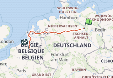
Trail Camping car of 783 km to be discovered at Saxony-Anhalt, Stendal, Schönhausen (Elbe). This trail is proposed by vinwee.

Elevation profile

Positioning

Country:
Germany
Region :
Saxony-Anhalt
Department/Province :
Stendal
Municipality :
Schönhausen (Elbe)
Location:
Unknown
Start:(UTM)
305767 ; 5830580 (33U) N.

Trails nearby

Trail On foot Rathenow - Eschhorstwanderweg - Photo
On foot
PRO

On foot

Easy
Rathenow, Brandenburg, Havelland, Germany
7.9 km | 8.7 km-effort
1h 58min
Yes
Trail On foot Rathenow - Markgrafenwanderweg - Photo
On foot
PRO

On foot

Easy
Rathenow, Brandenburg, Havelland, Germany
3.3 km | 3.9 km-effort
52min
No
Trail On foot Rathenow - Husarenwanderweg - Photo
On foot
PRO

On foot

Easy
Rathenow, Brandenburg, Havelland, Germany
3.1 km | 3.3 km-effort
45min
Yes


Close
My subscriptions