


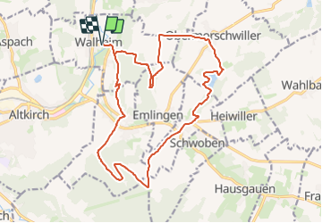
Walheim - Tagsdorf 2

Alain28/01
User

Length
19.5 km

Max alt
393 m

Uphill gradient
408 m
Km-Effort
25 km

Min alt
269 m

Downhill gradient
408 m
Boucle
Yes
Creation date :
2024-01-09 11:28:03.925
Updated on :
2024-01-09 11:29:13.67
5h39
Difficulty : Medium

FREE GPS app for hiking
 SityTrail
IGN / Geographical institutes
SityTrail Plus
The world is yours!
About
Trail Walking of 19.5 km to be discovered at Grand Est, Haut-Rhin, Walheim. This trail is proposed by Alain28/01.
Positioning
Country:
France
Region :
Grand Est
Department/Province :
Haut-Rhin
Municipality :
Walheim
Location:
Unknown
Start:(Dec)
Start:(UTM)
369952 ; 5277943 (32T) N.
Comments