Trail Walking Corrençon-en-Vercors - Château Julien  - Photo
© OpenStreetMap contributors
Length
Length
12.3 km
Max alt
Max alt
1556 m
Uphill gradient
Uphill gradient
476 m
Km-Effort
Km-Effort  
18.7 km
Min alt
Min alt
1143 m
Downhill gradient
Downhill gradient
477 m
Boucle
Boucle
Yes
Creation date :
2024-01-11 08:13:11.337
Updated on :
2024-01-12 08:50:39.832

(0 Reviews)

Walking
Walking
4h14
Difficulty : Difficult

Scan this QR Code to open this trail in the SityTrail application

FREE GPS app for hiking

Logo SityTrail SityTrail

IGN / Geographical institutes

Download SityTrail from the App Store Download SityTrail from Google Play

Logo SityTrail SityTrail World

The world is yours!

Download SityTrail from the App Store Download SityTrail from Google Play Download SityTrail on Huawei AppGallery

About

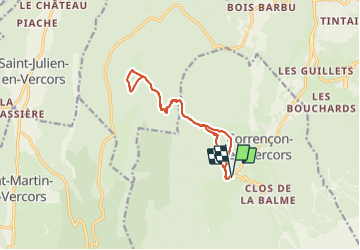
Trail Walking of 12.3 km to be discovered at Auvergne-Rhône-Alpes, Isère, Corrençon-en-Vercors. This trail is proposed by GuyVachet.

Description

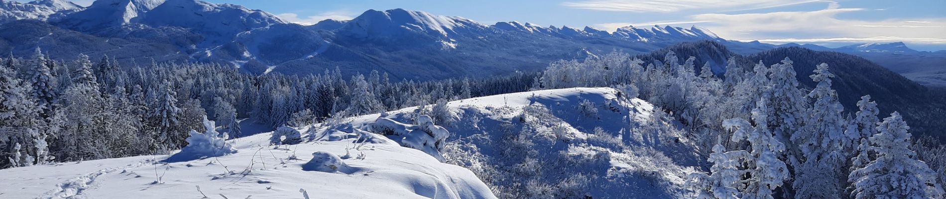
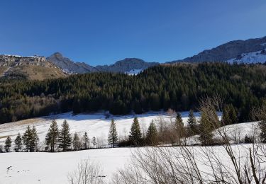
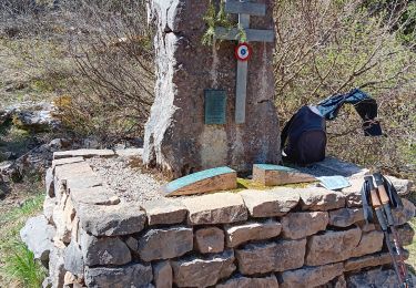
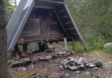
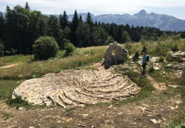
Itinéraire en raquettes essentiellement en forêt avec une boucle sur le plateau de Château Julien en point d'orgue. Cet endroit offre une superbe vue sur toute la chaine du Vercors, du Moucherotte jusqu'au Grand Veymont avec la Grande Moucherolle au centre. Le parcours bien balisé commence tranquillement avec l'itinéraire n°6 jusqu'à la Cabane de Malaterre puis en suivant l'itinéraire n°17, la pente se relève pour arriver au Scialet de Malaterre (puit vertical de 120m) et enfin au plateau où le paysage s'ouvre. Il faut monter à la table d’orientation du sommet pour mieux apprécier la vue panoramique. Retour à la Porte Nordique des Hauts-Plateaux en reprenant l'itinéraire aller avec un détour par la Grotte de la Glacière.

Elevation profile

Photos

Positioning

Country:
France
Region :
Auvergne-Rhône-Alpes
Department/Province :
Isère
Municipality :
Corrençon-en-Vercors
Location:
Unknown
Start:(UTM)
698355 ; 4988754 (31T) N.

Trails nearby

Trail Walking Villard-de-Lans - villard col des 2 soeurs - Photo
Walking
arnaudconde

Walking

Medium
(1)
Villard-de-Lans, Auvergne-Rhône-Alpes, Isère, France
7.7 km | 13.8 km-effort
2h 45min
Yes
Trail Walking Villard-de-Lans - cabane de robon - Photo
Walking
Sylvie Mathiot

Walking

Very easy
(1)
Villard-de-Lans, Auvergne-Rhône-Alpes, Isère, France
10.2 km | 15.8 km-effort
5h 25min
Yes
Trail Mountain bike Corrençon-en-Vercors - Grande Traversée des PréAlpes à VTT : Corrençon en Vercors - La Chapelle en Vercors - Photo
Mountain bike
tracegps

Mountain bike

Difficult
(1)
Corrençon-en-Vercors, Auvergne-Rhône-Alpes, Isère, France
25 km | 36 km-effort
3h 30min
No
Trail Walking Villard-de-Lans - Le sentier Peronnard et le Pas de l'OEille - Photo
Walking
tracegps

Walking

Easy
(1)
Villard-de-Lans, Auvergne-Rhône-Alpes, Isère, France
13.7 km | 25 km-effort
6h 0min
Yes
Trail Walking Villard-de-Lans - col_vert - Photo
Walking
vrolanta

Walking

Medium
(2)
Villard-de-Lans, Auvergne-Rhône-Alpes, Isère, France
8.7 km | 16.4 km-effort
3h 0min
Yes
Trail Mountain bike Villard-de-Lans - La Royale (variante) - Photo
Mountain bike
flyingdad

Mountain bike

Medium
(1)
Villard-de-Lans, Auvergne-Rhône-Alpes, Isère, France
28 km | 37 km-effort
4h 0min
Yes
Trail Walking Corrençon-en-Vercors - Corrençon en Vercors (le 45E parallèle) - Photo
Walking
ISATR

Walking

Medium
Corrençon-en-Vercors, Auvergne-Rhône-Alpes, Isère, France
10.8 km | 14.1 km-effort
3h 22min
Yes
Trail Walking Corrençon-en-Vercors - 38 tête chaudière  - Photo
Walking
himba26100

Walking

Medium
Corrençon-en-Vercors, Auvergne-Rhône-Alpes, Isère, France
10.8 km | 22 km-effort
7h 3min
Yes
Trail Walking Saint-Martin-en-Vercors - La Sambue et le belvedere de Chateau Julien - Photo
Walking
ajd26

Walking

Very difficult
Saint-Martin-en-Vercors, Auvergne-Rhône-Alpes, Drôme, France
15.7 km | 24 km-effort
5h 27min
Yes


Close
My subscriptions