


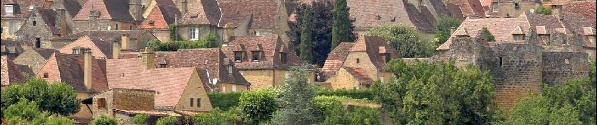
Domme_Vitrac_Marobert

jagarnier
User GUIDE
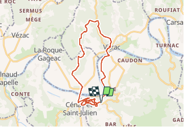

Length
16.4 km

Max alt
217 m

Uphill gradient
414 m
Km-Effort
22 km

Min alt
67 m

Downhill gradient
411 m
Boucle
Yes
Creation date :
2024-01-22 10:28:04.886
Updated on :
2024-05-02 05:43:12.426
5h15
Difficulty : Medium

FREE GPS app for hiking
 SityTrail
IGN / Geographical institutes
SityTrail Plus
The world is yours!
About
Trail Walking of 16.4 km to be discovered at New Aquitaine, Dordogne, Domme. This trail is proposed by jagarnier.
Photos

Positioning
Country:
France
Region :
New Aquitaine
Department/Province :
Dordogne
Municipality :
Domme
Location:
Unknown
Start:(Dec)
Start:(UTM)
359133 ; 4962504 (31T) N.
Comments
