


Pointe sud de la Vénasque

orsel
User GUIDE

Length
10.3 km

Max alt
2575 m

Uphill gradient
967 m
Km-Effort
23 km

Min alt
1554 m

Downhill gradient
1015 m
Boucle
No
Creation date :
2024-01-25 07:55:27.4
Updated on :
2024-01-25 12:50:27.396
4h22
Difficulty : Medium

FREE GPS app for hiking
 SityTrail
IGN / Geographical institutes
SityTrail Plus
The world is yours!
About
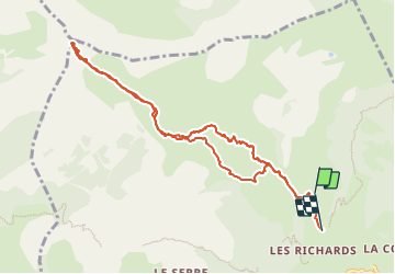
Trail Touring skiing of 10.3 km to be discovered at Provence-Alpes-Côte d'Azur, Hautes-Alpes, Saint-Jean-Saint-Nicolas. This trail is proposed by orsel.
Positioning
Country:
France
Region :
Provence-Alpes-Côte d'Azur
Department/Province :
Hautes-Alpes
Municipality :
Saint-Jean-Saint-Nicolas
Location:
Unknown
Start:(Dec)
Start:(UTM)
280717 ; 4951966 (32T) N.
Comments