Trail Walking Cap-d'Ail - Cap d’ail - Nice Riquier - Photo
 ETMU5496
ETMU5496

User

© OpenStreetMap contributors
Length
Length
22 km
Max alt
Max alt
689 m
Uphill gradient
Uphill gradient
962 m
Km-Effort
Km-Effort  
35 km
Min alt
Min alt
14 m
Downhill gradient
Downhill gradient
975 m
Boucle
Boucle
No
Creation date :
2024-01-28 07:08:35.0
Updated on :
2024-01-29 14:57:05.741

(0 Reviews)

Walking
Walking
7h59
Difficulty : Medium

Scan this QR Code to open this trail in the SityTrail application

FREE GPS app for hiking

Logo SityTrail SityTrail

IGN / Geographical institutes

Download SityTrail from the App Store Download SityTrail from Google Play

Logo SityTrail SityTrail World

The world is yours!

Download SityTrail from the App Store Download SityTrail from Google Play Download SityTrail on Huawei AppGallery

About

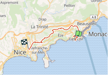
Trail Walking of 22 km to be discovered at Provence-Alpes-Côte d'Azur, Maritime Alps, Cap-d'Ail. This trail is proposed by ETMU5496.

Description

Prendre train gare Nice Riquier pour Cap d'ail
retour par les balcons d'Azur
IBP = 94

Elevation profile

Photos

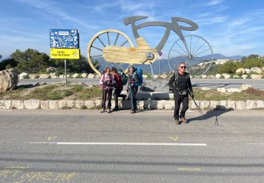
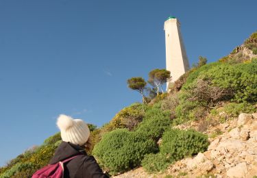
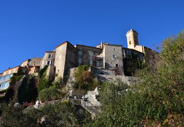
51 photos in total. Please click on a photo to see them all in the gallery.

Positioning

Country:
France
Region :
Provence-Alpes-Côte d'Azur
Department/Province :
Maritime Alps
Municipality :
Cap-d'Ail
Location:
Unknown
Start:(UTM)
370650 ; 4842107 (32T) N.

Trails nearby

Trail On foot Èze - Circuit du mont Bastide - Photo
On foot
PRO

On foot

Easy
Èze, Provence-Alpes-Côte d'Azur, Maritime Alps, France
7 km | 14.7 km-effort
3h 20min
Yes
Trail Walking Èze - Mont Bastide, sentier de Nietzsche - Photo
Walking
PEBREJOSIANE

Walking

Easy
(1)
Èze, Provence-Alpes-Côte d'Azur, Maritime Alps, France
7.2 km | 15.1 km-effort
3h 15min
Yes
Trail Other activity La Turbie - fort de la Revere  - Photo
Other activity
juleyann

Other activity

Very easy
(1)
La Turbie, Provence-Alpes-Côte d'Azur, Maritime Alps, France
8.4 km | 12 km-effort
1h 37min
Yes
Trail Walking Saint-Jean-Cap-Ferrat - w-frankrijk-tour-du-cap-ferrat - Photo
Walking
gpstracks

Walking

Very easy
(1)
Saint-Jean-Cap-Ferrat, Provence-Alpes-Côte d'Azur, Maritime Alps, France
6.5 km | 8.6 km-effort
Unknown
No
Trail Walking Èze - eze 221213 - Photo
Walking
legios84

Walking

Medium
(1)
Èze, Provence-Alpes-Côte d'Azur, Maritime Alps, France
9.9 km | 14.7 km-effort
2h 4min
Yes
Trail Walking Saint-Jean-Cap-Ferrat - Tour du Cap Ferrat - Photo
Walking
tracegps

Walking

Medium
(4)
Saint-Jean-Cap-Ferrat, Provence-Alpes-Côte d'Azur, Maritime Alps, France
8.9 km | 11.2 km-effort
2h 0min
Yes
Trail Walking Cap-d'Ail - Nice Cap d'Ail en train et retour par les cretes - Photo
Walking
jouans

Walking

Very difficult
Cap-d'Ail, Provence-Alpes-Côte d'Azur, Maritime Alps, France
23 km | 36 km-effort
8h 6min
No
Trail Walking Saint-Jean-Cap-Ferrat - Cap Ferrat - Photo
Walking
Jean-François Thibaud

Walking

Medium
Saint-Jean-Cap-Ferrat, Provence-Alpes-Côte d'Azur, Maritime Alps, France
8.2 km | 11 km-effort
3h 20min
No
Trail Walking Èze - Èze Bord de Mer - Èze Village - Fort de Revère - Cime de la Forna - La Turbie - Monaco - Photo
Walking
LtZIP

Walking

Difficult
Èze, Provence-Alpes-Côte d'Azur, Maritime Alps, France
15.9 km | 27 km-effort
4h 51min
No


Close
My subscriptions