


Aussois village - Le Montana

Jamyfredo
User
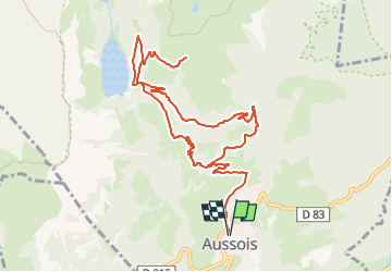

Length
12.5 km

Max alt
2177 m

Uphill gradient
699 m
Km-Effort
22 km

Min alt
1488 m

Downhill gradient
699 m
Boucle
Yes
Creation date :
2024-01-31 19:32:52.098
Updated on :
2024-02-01 17:58:50.97
4h08
Difficulty : Medium

FREE GPS app for hiking
 SityTrail
IGN / Geographical institutes
SityTrail Plus
The world is yours!
About
Trail Walking of 12.5 km to be discovered at Auvergne-Rhône-Alpes, Savoy, Aussois. This trail is proposed by Jamyfredo.
Description
Belle randonnée dans son ensemble avec une halte au Montana. Assez pentue à l'aller par de petits sentiers mais plus roulante sur le retour par la route (piste verte en hiver).
Positioning
Country:
France
Region :
Auvergne-Rhône-Alpes
Department/Province :
Savoy
Municipality :
Aussois
Location:
Unknown
Start:(Dec)
Start:(UTM)
322695 ; 5010812 (32T) N.
Comments