


Lac de la Lauch - USM AR

jmbilger
User
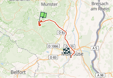

Length
58 km

Max alt
1216 m

Uphill gradient
684 m
Km-Effort
70 km

Min alt
218 m

Downhill gradient
1346 m
Boucle
No
Creation date :
2024-02-01 09:47:09.0
Updated on :
2024-02-02 07:08:11.092
4h22
Difficulty : Unknown

FREE GPS app for hiking
 SityTrail
IGN / Geographical institutes
SityTrail Plus
The world is yours!
About
Trail Walking of 58 km to be discovered at Grand Est, Haut-Rhin, Lautenbachzell. This trail is proposed by jmbilger.
Positioning
Country:
France
Region :
Grand Est
Department/Province :
Haut-Rhin
Municipality :
Lautenbachzell
Location:
Unknown
Start:(Dec)
Start:(UTM)
354192 ; 5310748 (32T) N.
Comments