


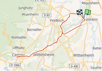
2024 02 04 trente cinq km de voie verte au depart d'Ensisheim

staubalex
User

Length
35 km

Max alt
297 m

Uphill gradient
170 m
Km-Effort
37 km

Min alt
211 m

Downhill gradient
171 m
Boucle
Yes
Creation date :
2024-02-02 17:56:27.446
Updated on :
2024-02-02 17:58:05.829
3h00
Difficulty : Easy

FREE GPS app for hiking
 SityTrail
IGN / Geographical institutes
SityTrail Plus
The world is yours!
About
Trail Other activity of 35 km to be discovered at Grand Est, Haut-Rhin, Ensisheim. This trail is proposed by staubalex.
Positioning
Country:
France
Region :
Grand Est
Department/Province :
Haut-Rhin
Municipality :
Ensisheim
Location:
Unknown
Start:(Dec)
Start:(UTM)
375704 ; 5302905 (32T) N.
Comments