


Sireuil GR 4

taguette
User
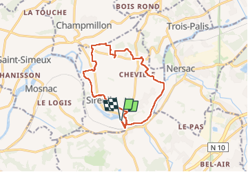

Length
13.8 km

Max alt
77 m

Uphill gradient
121 m
Km-Effort
15.4 km

Min alt
21 m

Downhill gradient
120 m
Boucle
Yes
Creation date :
2024-02-12 13:53:19.92
Updated on :
2024-02-12 16:46:19.746
2h52
Difficulty : Easy

FREE GPS app for hiking
 SityTrail
IGN / Geographical institutes
SityTrail Plus
The world is yours!
About
Trail Walking of 13.8 km to be discovered at New Aquitaine, Charente, Sireuil. This trail is proposed by taguette.
Positioning
Country:
France
Region :
New Aquitaine
Department/Province :
Charente
Municipality :
Sireuil
Location:
Unknown
Start:(Dec)
Start:(UTM)
267742 ; 5054733 (31T) N.
Comments