


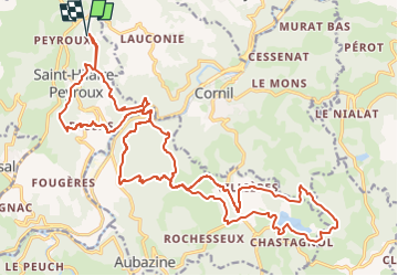
St Hilaire Peyroux

Gpoujade
User

Length
30 km

Max alt
496 m

Uphill gradient
1054 m
Km-Effort
44 km

Min alt
145 m

Downhill gradient
1057 m
Boucle
Yes
Creation date :
2024-02-13 09:43:03.519
Updated on :
2024-02-15 11:00:01.407
3h02
Difficulty : Very difficult

FREE GPS app for hiking
 SityTrail
IGN / Geographical institutes
SityTrail Plus
The world is yours!
About
Trail Mountain bike of 30 km to be discovered at New Aquitaine, Corrèze, Saint-Hilaire-Peyroux. This trail is proposed by Gpoujade.
Description
Boucle au départ d'un village de St Hilaire Peyroux vers le Lac Du Coiroux par Le Tunnel De Bonnel
Positioning
Country:
France
Region :
New Aquitaine
Department/Province :
Corrèze
Municipality :
Saint-Hilaire-Peyroux
Location:
Unknown
Start:(Dec)
Start:(UTM)
394184 ; 5008746 (31T) N.
Comments