


Cosprons

nandaf
User
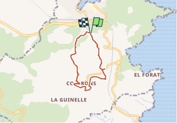

Length
5.5 km

Max alt
138 m

Uphill gradient
151 m
Km-Effort
7.5 km

Min alt
12 m

Downhill gradient
153 m
Boucle
Yes
Creation date :
2024-02-20 13:26:10.0
Updated on :
2024-02-20 16:37:39.414
1h51
Difficulty : Unknown

FREE GPS app for hiking
 SityTrail
IGN / Geographical institutes
SityTrail Plus
The world is yours!
About
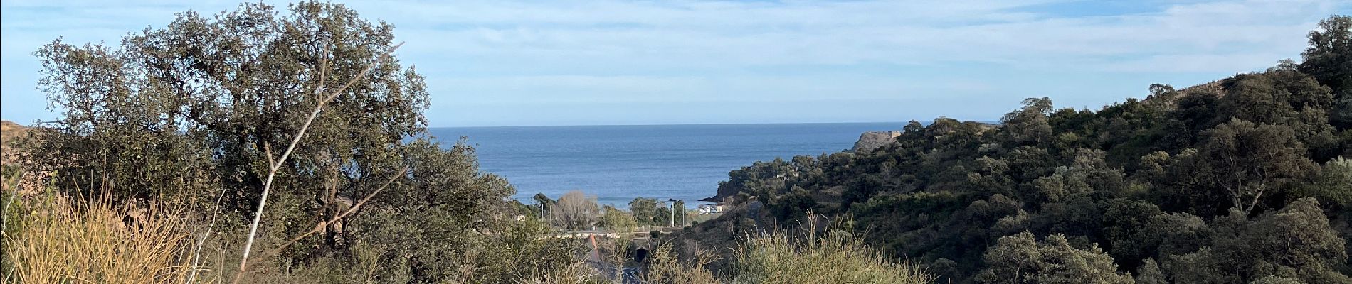
Trail Walking of 5.5 km to be discovered at Occitania, Pyrénées-Orientales, Port-Vendres. This trail is proposed by nandaf.
Description
Randonnée, boucle autour de Cosprons.
On passe devant une maison tournante
Photos


Positioning
Country:
France
Region :
Occitania
Department/Province :
Pyrénées-Orientales
Municipality :
Port-Vendres
Location:
Unknown
Start:(Dec)
Start:(UTM)
509098 ; 4706409 (31T) N.
Comments