Trail Snowshoes Auvare - Col de Sui - Photo
 bozo1970
bozo1970

User

© OpenStreetMap contributors
Length
Length
13.7 km
Max alt
Max alt
1746 m
Uphill gradient
Uphill gradient
751 m
Km-Effort
Km-Effort  
24 km
Min alt
Min alt
1078 m
Downhill gradient
Downhill gradient
756 m
Boucle
Boucle
Yes
Creation date :
2024-02-29 08:12:35.0
Updated on :
2024-02-29 17:08:13.115

(0 Reviews)

Snowshoes
Snowshoes
4h56
Difficulty : Difficult

Scan this QR Code to open this trail in the SityTrail application

FREE GPS app for hiking

Logo SityTrail SityTrail

IGN / Geographical institutes

Download SityTrail from the App Store Download SityTrail from Google Play

Logo SityTrail SityTrail World

The world is yours!

Download SityTrail from the App Store Download SityTrail from Google Play Download SityTrail on Huawei AppGallery

About

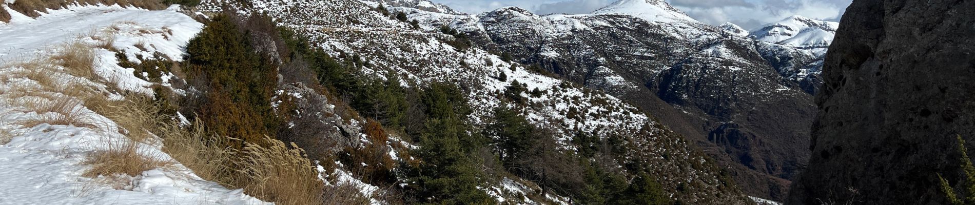
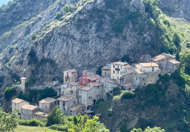
Trail Snowshoes of 13.7 km to be discovered at Provence-Alpes-Côte d'Azur, Maritime Alps, Auvare. This trail is proposed by bozo1970.
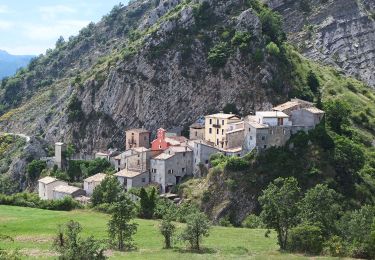
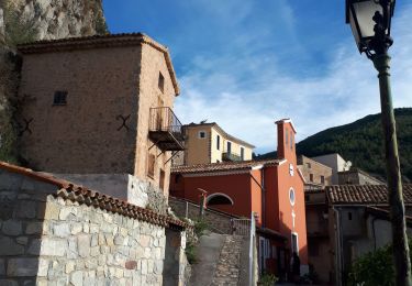
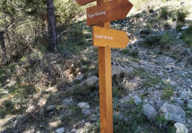
Description

Départ d’Auvare
Col du Mont en 30’ D  210 et 1km600
Baisse de Fleirel en 54’ D  330 et 2km600
Col de Pras en 1h23’ D  529 et 3km700
Col de Vigude en 2h18’ D  767 et 6km350
Balise 254 en 2h58 D  934 et 7km500
A/R en 5h D  995er 14km
40cm de neige tombée la veille, très collante
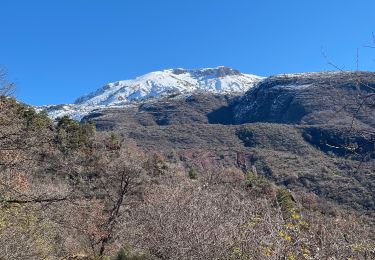
Impossible d’atteindre le Dôme de Barrot, trop loin, dommage !
Aucun animal

Elevation profile

Photos

Positioning

Country:
France
Region :
Provence-Alpes-Côte d'Azur
Department/Province :
Maritime Alps
Municipality :
Auvare
Location:
Unknown
Start:(UTM)
332152 ; 4872628 (32T) N.

Trails nearby

Trail On foot La Croix-sur-Roudoule - Tour du Mont d'Auvare - Photo
On foot
PRO

On foot

Easy
La Croix-sur-Roudoule, Provence-Alpes-Côte d'Azur, Maritime Alps, France
9.1 km | 17.8 km-effort
4h 3min
Yes
Trail On foot Puget-Théniers - Circuit des Aubrics - Photo
On foot
PRO

On foot

Easy
Puget-Théniers, Provence-Alpes-Côte d'Azur, Maritime Alps, France
6.3 km | 11.8 km-effort
2h 40min
Yes
Trail Walking Puget-Théniers - Puget théniers-Entrevaux par le col de Vélacs - Photo
Walking
PEBREJOSIANE

Walking

Medium
(1)
Puget-Théniers, Provence-Alpes-Côte d'Azur, Maritime Alps, France
14.3 km | 25 km-effort
6h 10min
No
Trail Snowshoes La Croix-sur-Roudoule - Haute Mihubi  - Photo
Snowshoes
bozo1970

Snowshoes

Difficult
La Croix-sur-Roudoule, Provence-Alpes-Côte d'Azur, Maritime Alps, France
14 km | 25 km-effort
5h 7min
Yes
Trail Walking Auvare - Auvare Dôme de Barrot - Photo
Walking
GrouGary

Walking

Difficult
Auvare, Provence-Alpes-Côte d'Azur, Maritime Alps, France
17.7 km | 33 km-effort
6h 13min
No
Trail Walking Auvare - Auvare : le dôme de Barrot - Photo
Walking
ETMU5496

Walking

Difficult
Auvare, Provence-Alpes-Côte d'Azur, Maritime Alps, France
19.2 km | 34 km-effort
5h 36min
Yes
Trail On foot Puget-Rostang - Circuit de Mairola - Photo
On foot
PRO

On foot

Medium
Puget-Rostang, Provence-Alpes-Côte d'Azur, Maritime Alps, France
11.4 km | 23 km-effort
5h 11min
Yes
Trail Walking La Croix-sur-Roudoule - La Croix sur Roudoule - Photo
Walking
MIKARANDO

Walking

Difficult
La Croix-sur-Roudoule, Provence-Alpes-Côte d'Azur, Maritime Alps, France
10.2 km | 18.3 km-effort
3h 15min
Yes
Trail Walking Puget-Rostang - Puget Rostang à Auvare - Photo
Walking
MIKARANDO

Walking

Difficult
Puget-Rostang, Provence-Alpes-Côte d'Azur, Maritime Alps, France
12.2 km | 24 km-effort
3h 53min
Yes


Close
My subscriptions