Trail Walking Sare - Lizarrieta,  Zentinel, col des 3 bornes,  2024 03 04. - Photo

Lizarrieta, Zentinel, col des 3 bornes, 2024 03 04.

 DECHAMPD
DECHAMPD

User

© OpenStreetMap contributors
Length
Length
12.4 km
Max alt
Max alt
530 m
Uphill gradient
Uphill gradient
410 m
Km-Effort
Km-Effort  
17.8 km
Min alt
Min alt
381 m
Downhill gradient
Downhill gradient
413 m
Boucle
Boucle
Yes
Creation date :
2024-03-04 09:44:18.0
Updated on :
2024-03-14 15:35:23.415

(0 Reviews)

Walking
Walking
4h03
Difficulty : Difficult

Scan this QR Code to open this trail in the SityTrail application

FREE GPS app for hiking

Logo SityTrail SityTrail

IGN / Geographical institutes

Download SityTrail from the App Store Download SityTrail from Google Play

Logo SityTrail SityTrail World

The world is yours!

Download SityTrail from the App Store Download SityTrail from Google Play Download SityTrail on Huawei AppGallery

About

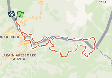
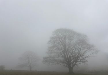
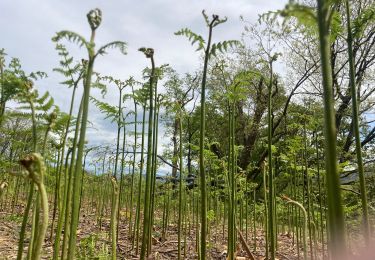
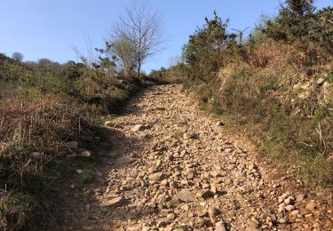
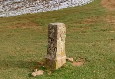
Trail Walking of 12.4 km to be discovered at New Aquitaine, Pyrénées-Atlantiques, Sare. This trail is proposed by DECHAMPD.

Description

col de Lizarrieta, refuge cabana-deUsategieta, Larrasaieska borda, Domikusantz, Lakainlepe, Maritoneko borda, Nabalsa, Otxobi, col des 3 bornes BF 56, Ainatarbe, col de Nabarlatz, les  palombières d'Etxalar.

Elevation profile

Photos

Points of interest

Point of interest Etxalar - BF 48 - Photo
DECHAMPD
ETXALAR 
Point of interest Sare - BF 51 - Photo
DECHAMPD
SARE 
Point of interest Sare - BF 52 - Photo
DECHAMPD
SARE 
Point of interest Etxalar - BF - Photo
DECHAMPD
ETXALAR 
Point of interest Etxalar - BF - Photo
DECHAMPD
ETXALAR 
Point of interest Etxalar - BF - Photo
DECHAMPD
ETXALAR 
Point of interest Sare - BF55 - Photo
DECHAMPD
SARE 
Point of interest Etxalar - Borne Frontière 56 - Photo
DECHAMPD
Point of interest Etxalar - four à chaux - Photo
DECHAMPD
ETXALAR 

Positioning

Country:
France
Region :
New Aquitaine
Department/Province :
Pyrénées-Atlantiques
Municipality :
Sare
Location:
Unknown
Start:(UTM)
612111 ; 4790703 (30T) N.

Trails nearby

Trail On foot Etxalar - SL-NA 5 Argarata - Santa Krutz - Photo
On foot
PRO

On foot

Easy
Etxalar, Navarre, Unknown, Spain
4.5 km | 5.7 km-effort
1h 17min
Yes
Trail Walking Sare - La rhune par la face EST - Photo
Walking
DECHAMPD

Walking

Medium
(1)
Sare, New Aquitaine, Pyrénées-Atlantiques, France
13.8 km | 26 km-effort
5h 10min
Yes
Trail Walking Sare - sare les palombieres - Photo
Walking
GUIDE
antignacs

Walking

Easy
Sare, New Aquitaine, Pyrénées-Atlantiques, France
15.8 km | 24 km-effort
4h 44min
Yes
Trail Walking Sare - atxuria zugaramurdi - Photo
Walking
jcaudron

Walking

Very easy
(3)
Sare, New Aquitaine, Pyrénées-Atlantiques, France
10.3 km | 18.7 km-effort
3h 50min
Yes
Trail Walking Sare - Palombieres ibantelli - Photo
Walking
GUIDE
antignacs

Walking

Easy
Sare, New Aquitaine, Pyrénées-Atlantiques, France
14.8 km | 0 m-effort
5h 6min
Yes
Trail Walking Sare - Atxuria tour par zugaramurdi - Photo
Walking
GUIDE
antignacs

Walking

Easy
Sare, New Aquitaine, Pyrénées-Atlantiques, France
14.7 km | 24 km-effort
4h 43min
Yes
Trail Walking Sare - Palombieres lizerieta variante  - Photo
Walking
GUIDE
antignacs

Walking

Easy
Sare, New Aquitaine, Pyrénées-Atlantiques, France
16 km | 23 km-effort
5h 13min
Yes
Trail Walking Sare - Circuit des trois bornes. Grottes de Sare - Photo
Walking
jaja64

Walking

Very easy
Sare, New Aquitaine, Pyrénées-Atlantiques, France
6.4 km | 11.9 km-effort
2h 50min
Yes
Trail On foot Sare - Chemin des Palombières - Photo
On foot
PRO

On foot

Easy
Sare, New Aquitaine, Pyrénées-Atlantiques, France
5.2 km | 7.9 km-effort
1h 47min
Yes


Close
My subscriptions