Trail Walking Montesquieu-des-Albères - Montesquieu des Albères - Photo
 nandaf
nandaf

User

© OpenStreetMap contributors
Length
Length
7.4 km
Max alt
Max alt
364 m
Uphill gradient
Uphill gradient
258 m
Km-Effort
Km-Effort  
10.9 km
Min alt
Min alt
154 m
Downhill gradient
Downhill gradient
258 m
Boucle
Boucle
Yes
Creation date :
2024-03-12 17:49:52.465
Updated on :
2024-03-12 17:51:43.222

(2 Reviews)

Walking
Walking
2h27
Difficulty : Medium

Scan this QR Code to open this trail in the SityTrail application

FREE GPS app for hiking

Logo SityTrail SityTrail

IGN / Geographical institutes

Download SityTrail from the App Store Download SityTrail from Google Play

Logo SityTrail SityTrail Plus

The world is yours!

Download SityTrail from the App Store Download SityTrail from Google Play Download SityTrail on Huawei AppGallery

About

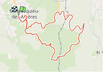
Trail Walking of 7.4 km to be discovered at Occitania, Pyrénées-Orientales, Montesquieu-des-Albères. This trail is proposed by nandaf.

Description

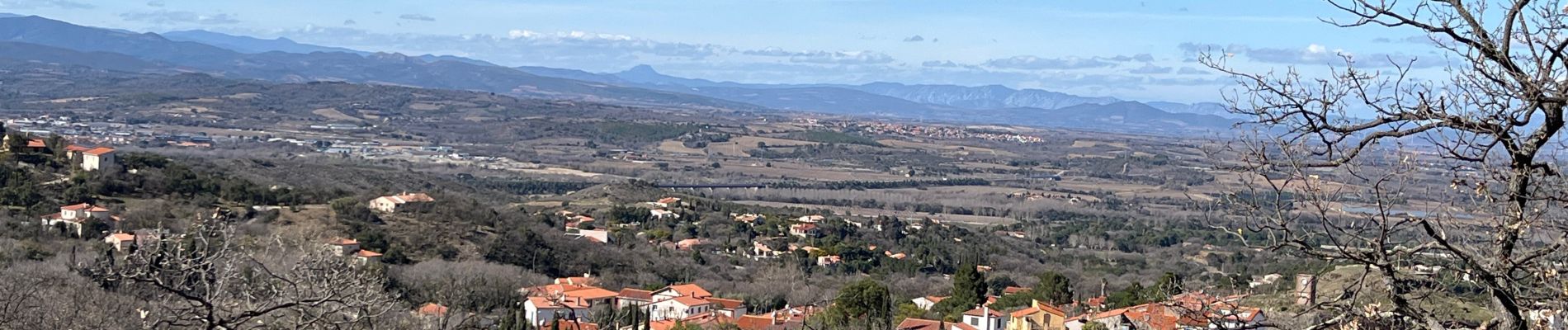
Boucle en partant du village de Montesquieu des Albères avec de belles vues tantôt sur la mer tantôt sur le Canigou.
Les derniers 2400m se font sur la route.
Petite halte au château de Montesquieu des Albères où l'on trouve une table d'orientation ainsi qu'une vue à 360°

Elevation profile

Photos

Positioning

Country:
France
Region :
Occitania
Department/Province :
Pyrénées-Orientales
Municipality :
Montesquieu-des-Albères
Location:
Unknown
Start:(UTM)
490149 ; 4707308 (31T) N.

Comments

Please log in to post a review or rate the element


Merci pour ce partage.


Close
My subscriptions